

MORNING: Mostly cloudy and in the 40s.
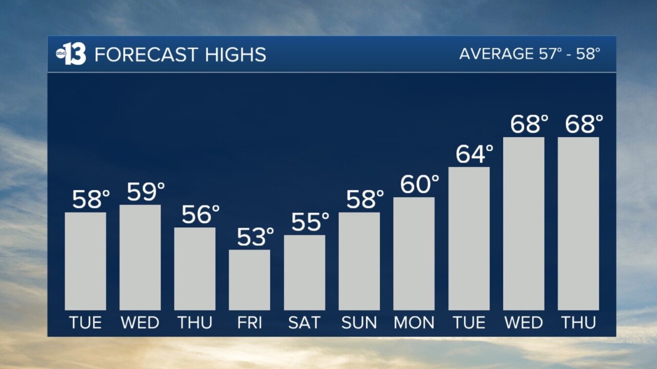
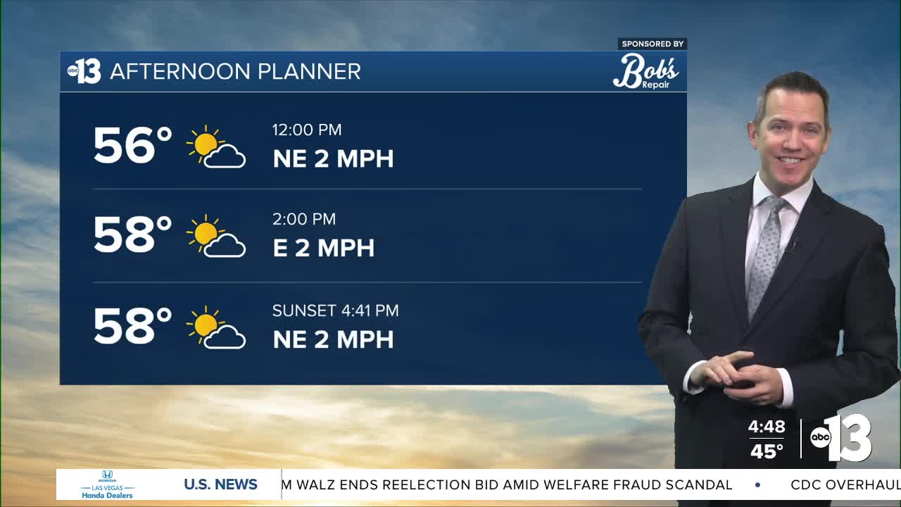
AFTERNOON: Partly sunny with highs in the upper 50s.
EVENING: Partly cloudy with readings falling to the low 50s.
TONIGHT: Lows in the low-and-mid 40s with a partly cloudy sky.
While today is dry, we'll watch a few isolated showers pass across southern Clark County on Wednesday, in places like Laughlin, otherwise we expect a partly cloudy sky and highs in the upper 50s.
A small chance of rain reaches Las Vegas late Wednesday night through Thursday morning, and afternoon highs only rebound to the mid 50s as northwest winds blow at 10-20 mph.
Friday remains blustery, with north winds at 10-20 mph, and wake-up temperatures in the upper 30s will feel even colder due to the brisk conditions.
The weekend looks calm, but cold. We'll wake up to the mid 30s Saturday and despite sunshine only see highs in the mid 50s.
Sunday starts in the upper 30s and finishes in the upper 50s as winds stay calm and the sky turns mostly sunny.
We anticipate a warming trend next week, from near 60° Monday to the upper 60s Wednesday and Thursday. That would be the mildest air for Las Vegas since before Christmas.