

MORNING: Partly cloudy with 80s early and 90s after 9 a.m.
AFTERNOON: Trending hotter, around 108° by 4 p.m. with a partly cloudy sky and gusts near 15 mph.
EVENING: Temperatures won't drop to the 90s until 10 p.m.
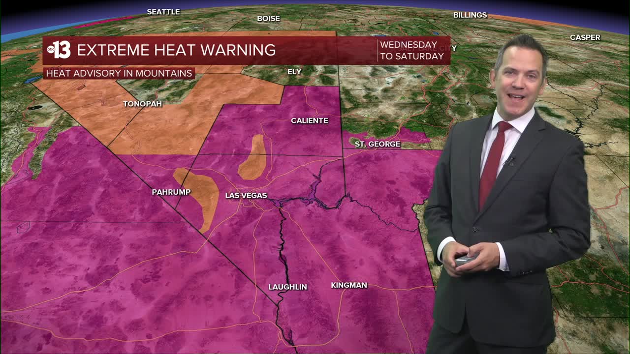
An Extreme Heat Warning is in effect from 8 a.m. today through 11 p.m. Saturday. The heat risk is "major" Wednesday, Thursday, and Friday as highs range from 108° to 109°, meaning anyone outside without enough water or access to shade may feel health impacts from the heat.

Humidity increases Friday and this weekend, teeing up daytime monsoon storm chances. The opportunities for downpours containing lightning and gusty winds sits at 30% Friday, 50% Saturday and Sunday, and 40% Monday and Tuesday.
Nighttime lows will be warm, in the mid-to-upper 80s, all week, as well as early next week.
There's a chance highs may be limited to the 90s next week on Tuesday and Wednesday as monsoon storm chances linger.
The UV index is "very high" from 11 a.m. to 2 p.m. (sunburn in 15 minutes). Sunscreen, a broad hat, and light-colored, lightweight clothing are smart if you're outside for any length of time between 9:00 a.m. and 4:00 p.m.
The forecast pollen levels are "medium" this week, with ragweed, chenopods, and grass listed as the predominant pollen types.
