


LAS VEGAS (KTNV) — Southern Nevada braced for heavy rains, thunderstorms, and flooding this weekend as Hurricane Hilary made its way toward the southwestern U.S.
Sunday, Hilary made landfall as a tropical storm in Mexico's Baja Peninsula and moved north toward Southern California. It will be the first tropical storm to hit Southern California in 84 years.
As of Monday morning, Mt. Charleston and Lee Canyon were closed to the public due to flood damage, and residents were said to be sheltering in place. The areas received 6-8 inches of rain over the weekend.
Flooding damaged Kyle Canyon Road, which was shut down at Deer Creek Road. Members of the public were asked to avoid the area.
UPDATE: SR-157 (Kyle Canyon Rd) is closed at SR-158 (Deer Creek Rd) due to flood damage. Crews are assessing the situation. There is no updated estimate for reopening at this time. pic.twitter.com/reh0rvuIme
— Nevada DOT Vegas (@nevadadotvegas) August 21, 2023
EVACUATIONS
Sunday, Mohave County officials issued a GO Evacuation Order for Temple Bar and the Willow Beach area of Lake Mead.
"Due to flooding risks from Tropical Storm Hilary," Mohave County Sheriff's Office said in a Facebook post. "National Park Service is requesting that everyone in the area evacuate to higher elevations."
EMERGENCY DECLARATIONS
Officials in Clark and Nye counties declared states of emergency to mobilize additional resources in anticipation of "major to historic" flood impacts in parts of Southern Nevada.
City and county officials reminded valley residents to stay indoors during the storm unless it's an emergency, avoid flooded roadways, and have an at-home emergency kit on hand.
On Saturday night, Clark County announced that it would be taking a lead role in preparations ahead of inclement weather, as well as in responses to emergencies. Gov. Joe Lombardo also announced his activation of 100 Nevada National Guard troops on Friday night to help distribute resources to residents and provide aid in emergency situations.
FLASH FLOOD WARNING
The National Weather Service issued a flash flood warning for Clark County on Friday, which will remain in effect until Monday at 5 p.m.
According to officials, affected areas included Las Vegas, Henderson, Spring Valley, Paradise, Southern Highlands, Enterprise, Mountains Edge, Green Valley, Summerlin, Harry Reid International Airport, and Silverado Ranch.
⚠️Flash Flood Warning⚠️until 845 pm PDT/MST for far southern Nevada, lower Colorado River Valley and western Mohave County. Heavy rain will lead to flash flooding of normally dry washes and other drainages susceptible to runoff. Turn Around, don't drown. #nvwx #cawx #azwx pic.twitter.com/1DIIJfToBE
— NWS Las Vegas (@NWSVegas) August 19, 2023
The City of Las Vegas identified several high-risk flooding areas, including:
- Buffalo & Rainbow between Cactus & Mountains Edge Parkway
- Jones to Dean Martin
- Cactus to Blue Diamond
- Decatur & Silverado Ranch
- St. Rose between Eastern & Coronado Center Drive
City officials also highlighted several washes that are at risk of overflowing:
- Green Valley & Windmill
- Stephanie & Patrick
- Desert Inn and Hollywood
Clark County issued flooding safety tips for residents, including:
- Don’t allow children or pets to play in or near floodwaters, which are fast-moving and can contain dangerous debris and chemicals.
- Never drive through a flooded road or around barricades. It can be difficult to determine how deep floodwaters are and floodwaters can rise dramatically in minutes.
- If you are caught in a sudden storm that may cause flooding it is usually safer for you to stay where you are and wait out the storm rather than trying to drive through it.
- If you are driving when the storm hits, think about finding some ground higher than the street to pull onto until the storm passes.
- If you get stuck in a stalled car, it may be safer to stay with your vehicle. Fast-moving water, even only a few inches deep can quickly sweep you off your feet.
Clark County Officials Advise Public to Brace for Flash Flooding Due to Impacts from #HurricaneHilary.#Vegas #LasVegas #ClarkCounty #VegasWeather
— Clark County Nevada (@ClarkCountyNV) August 19, 2023
⬇️ pic.twitter.com/ihUSRuHmta
The City of Henderson provided free sandbags to residents throughout the weekend, though officials say that sand will not be included. Residents could pick up those sandbags on Saturday and Sunday from 9 a.m. to noon at the Heritage Park Senior Facility and Whitney Ranch Recreation Center.
At 12:11 p.m. Sunday, Henderson officials said they were out of sandbags.
We are now out of sandbags at both locations.⁰⁰Find helpful flood safety tips here ➡️ https://t.co/XYSmM6Yufh https://t.co/PqWcXxw8Do
— City of Henderson (@cityofhenderson) August 20, 2023
The City of Las Vegas is also providing sandbags and sand, which can be picked up at the West Yard at 2950 Ronemus Drive, near Buffalo Drive and Cheyenne Avenue, or at the East Yard at 3128 East Bonanza Road, which is located near Bonanza and Pecos roads.
HIGH WIND WARNING
The National Weather Service issued a high wind warning from Sunday afternoon through early Monday morning, with winds expected to peak overnight. Southeast wind gusts could hit 50 mph Sunday night in Las Vegas, with gusts of 60 to 70 mph forecast for the Spring Mountains.
High winds could blow down trees and power outages are possible, according to NWS officials.
"Strong winds will be relatively brief as the remains of decaying Hilary lift through the western Mojave Desert," NWS Las Vegas said. "Several hours of strong winds in the evening are likely with gusts of 50 to 60 mph in the valley and 70 mph near Mt. Charleston."
POWER OUTAGES
NV Energy reminded customers to be prepared and safe this weekend by signing up for outage alerts. Officials say emergency crews will be on standby in case of power outages caused by the extreme weather.
Around 2 p.m. Sunday, about 2,650 customers were without power in the south, central and downtown area. Officials updated the outages around 3:30 p.m. with only four customers without power.
SCHOOL CLOSURES
Clark County School District says that it is "closely monitoring" the incoming storm, though classes are still currently on for Monday.
— CCSD (@ClarkCountySch) August 19, 2023
The Nye County Board of Commissioners said because of the local emergency and recommendation of shelter in place, Nye County School District schools will be closed Monday.
EVENT CANCELLATIONS
Due to inclement weather, the Pop 2000 Tour, which is at the Palms casino, is moving venues. It was originally scheduled to be at the SOAK Pool, but casino officials said the party is moving inside to the KAOS nightclub.
📸🌧️ UPDATE: For safety reasons, tonight's Photo Op at @CaesarsPalace is canceled due to inclement weather. Our apologies for any inconvenience. The rest of the Strip will still light up Pink and we'll see everyone at the show! #BORNPINKinVegas #VivaLasBlinks
— Vegas (@Vegas) August 19, 2023
FLIGHT DELAYS AND CANCELLATIONS
As of 9 a.m. on Monday, there are 111 delays at Harry Reid International Airport with 53 cancellations.
The Federal Aviation Administration said their website is available to check on flight statuses.
Special #HurricaneHilary Outlook: Severe weather may cause delays this afternoon for @flyLAXairport, @SanDiegoAirport, @PHXSkyHarbor & @LASairport. Airlines have adjusted flight schedules for #Hilary. Visit https://t.co/smgdqJN3td for your airport status. #FAAWeatherSquad #SoCal pic.twitter.com/ogsxRcJsM1
— The FAA ✈️ (@FAANews) August 20, 2023
PARK CLOSURES
The Bureau of Land Management announced on Friday that both the visitor center and the Scenic Loop at Red Rock National Conservation Area will be closed over the weekend.
Similarly, the visitor center and surrounding roads at Sloan Canyon National Conservation Area will be closed.
Lake Mead National Recreation Area announced a "complete closure" of the park for recreational activity from Saturday at 5 p.m. through Monday at the latest. On Friday night, officials reported that the Las Vegas Boat Harbor had "sustained damage" from a "severe weather event" on the lake. No injuries were reported, though the damage is still being assessed.
Lake Mead officials confirmed that the park is opening Tuesday since it's Saturday closure.
“Thankfully, there were no injuries and facilities received minimal damage in the wake of this storm,” said Acting Superintendent Mike Gauthier. “We are pleased to announce we are open for business again.”
Some areas of Lake Mead will still be closed, according to a media release. The concessioner-operated Las Vegas Boat Harbor will remain closed as it was "severely damaged" on Friday, and the Callville Boat Marina has no power.
Officials want to let visitors know that no marina fuel is available in the Boulder Basin.
Additional closures were announced on Friday for Death Valley National Park and Spring Mountains National Recreation Area, including Lee Canyon. All guest orders were canceled, and officials said customers would receive more details by email.
⛈ The US Forest Service has closed the Spring Mountains National Recreation Area, including Lee Canyon, due to concerns over an incoming storm and potential flash flooding. As a result, operations will be suspended on Saturday and Sunday. pic.twitter.com/QDsGN7PtHw
— Lee Canyon (@LeeCanyonLV) August 18, 2023
Those closures are in place from Saturday, Aug. 19, at midnight through Monday, Aug. 21 at midnight. Forest Service officials said violating those rules could result in fines of up to $5,000 and up to six months in jail.
VIEWER PHOTOS
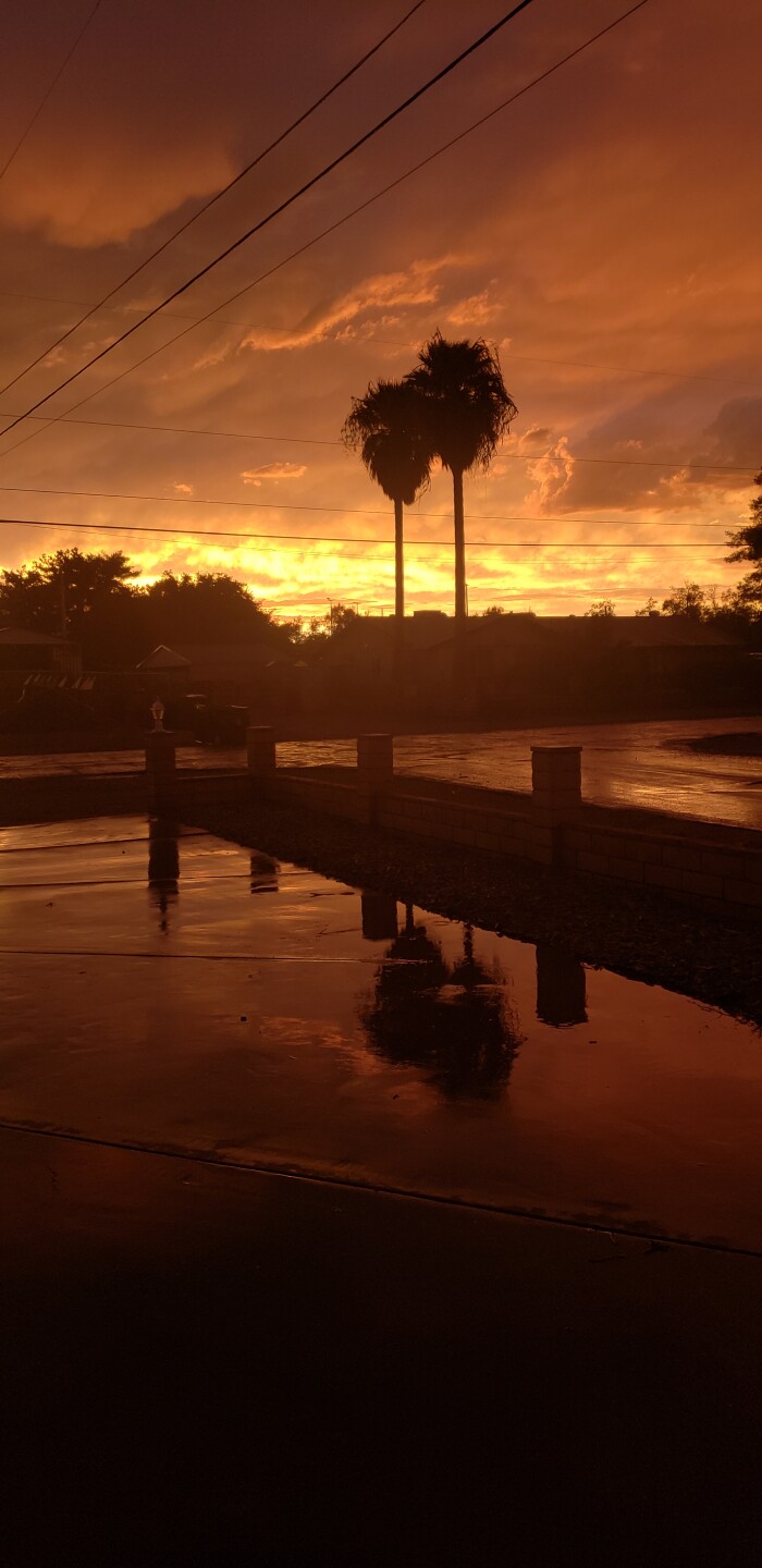


Check back later for more updates on how Tropical Storm Hilary is affecting our valley. Are you seeing flooding and storms in your area? Send us your photos and videos at photos@ktnv.com.
