

TODAY: Mostly cloudy. Light, variable winds. High: 65°
TONIGHT: Overnight rain after 10PM 25-75% chance. Low: 53°
CHRISTMAS EVE: 100% chance of rain after 10AM. Breezy with gusts up to25pmh High: 65°
A soggy XMas Eve is ahead for us!
Today we'll increasing cloud which is a precursor to a major winter storm expected tomorrow. Some sprinkles or virga rain could manifest this afternoon (probability under 15%).
Overnight after 10PM is when rain chances truly skyrocket from 25-75% in Las Vegas. At 10 AM Wednesday rain chances grow to 100%. Widespread rain continues through the overnight hours. Thursday, showers become more sparce with a 60% chance of rain and a slight chance of thunderstorms developing. It will be breezy both Christmas Eve and Christmas Day with gusts up to 25mph.
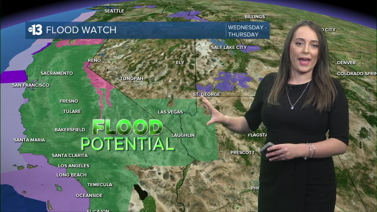
A Flood Watch has been issued for Clark County and Southern Nye County going into effect tomorrow at 4AM. Excessive flooding could cause urban ponding, rising stream waters, and flash flood potential. This alert lasts 24 hours. Remember, never drive into a flooded roadway!
Central Nevada will see Wind Advisories in Nye County, Esmeralda and Lincoln Counties go into effect today at 4PM. A Lake Wind Advisory goes into effect for Lake Mead and the Lower Colorado River Valley Wednesday at 7AM. These alerts have been issued through Thursday 10PM.
Las Vegas could see a half inch of rain accumulation in the next couple of days.
Mt . Charleston could see several inches of snowfall. However, some rain/snow mix could fall to higher elevations because of warm temperatures. That means dangerous, icy roads are on tap.
On another note...Los Angeles could see over 4 inches of rainfall. This system will slam the coast...possibly causing mudslides and major traffic impacts in California.
