

TONIGHT: Partly cloudy. Low: 47°
SUNDAY: Broken cloud cover. S SE 5-10mph winds. High: 69°
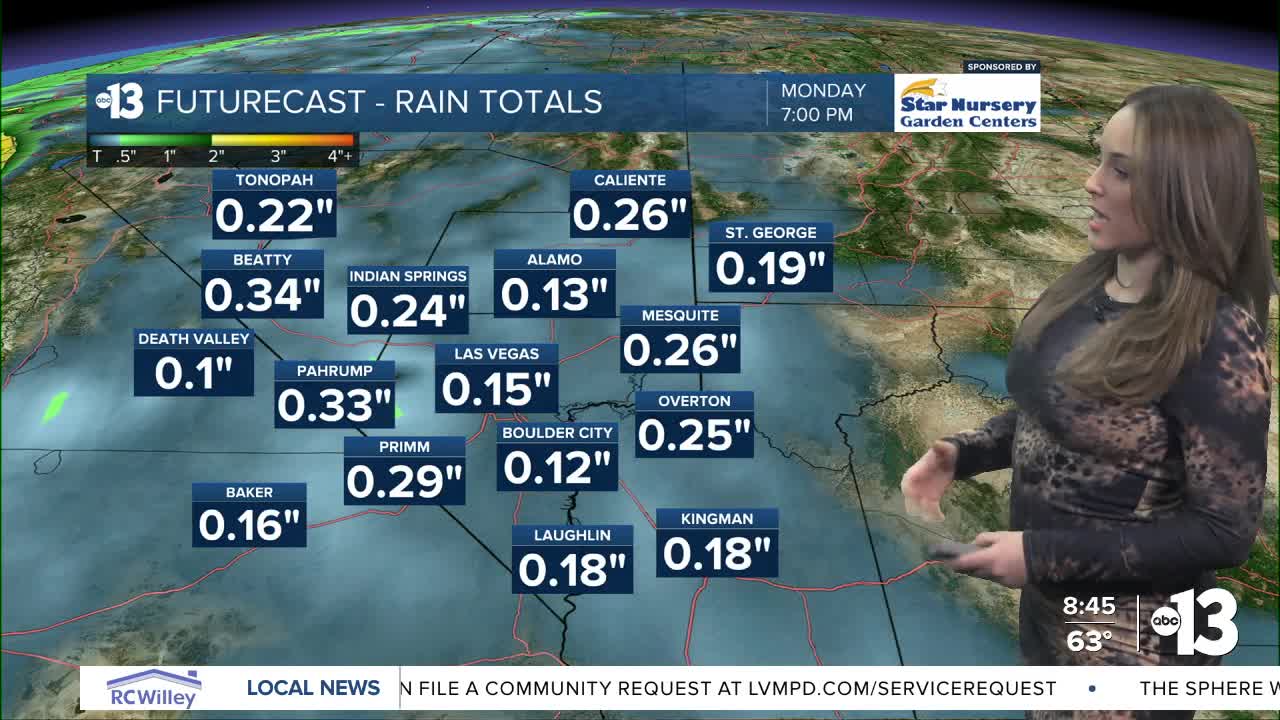
MONDAY: 80% showers mainly after 4pm. S 15-20mph with gusts up to 30mph. High: 69°
Mild weather will wrap up this Valentine's Day weekend with partly cloudy skies, a slight breeze with wind speeds up to 10mph and a high temp of 69° Sunday in Las Vegas. Believe it or not, that's about average for this time of year!
Active weather ramps up Monday — Presidents Day — with rain chances progressing from 20% in the morning to 80% in the evening with wind gusts up to 30mph. Snow is expected towards the higher elevations along with even windier conditions.
Winter Storm Watches have been issued for the Spring Mountains and Sheep Range above 5,000ft from Monday morning through Wednesday evening. 1-2 feet of snow could accumulate and gusts up to 50mph are anticipated. Great news for skiers and snowboards, but be safe if you head up to these higher elevations over the next few days!
Esmeralda and Nye Counties also have Winter Storm Watches in effect for mountain snow and some travel difficulties.
Wind Advisories have been issued for parts of Clark County that 11AM Monday through 2AM Tuesday. South winds 20-30mph with gusts up to 45mph could bring dangerous crosswinds, tree damage, power line damage and danger for small crafts on waterways. The Las Vegas metro area is largely not in this warning area, but most is oriented towards Lake Mead and the Lower Colorado River Valley.
Rain chances stick around Tuesday and Wednesday but showers will become more sparse.
Temperatures will drop back to the 50s in Las Vegas by Wednesday due to the influence of several rounds of low pressure pushing into the Pacific Southwest.