

OVERNIGHT: Increasing cloud cover. 30% chance of showers after 5AM. Breezy with SW winds 10-15mph and gusts up to 30mph. Low: 86°
TOMORROW: Mostly cloudy in the morning, then decreasing cloud cover. 40% chance of spotty showers before 12pm. Possible isolated t-storm. High: 105°
Thursday: Sunny and hot. Breezy with SW winds 10-20mph and gusts up to 30mph. High: 106°
Tuesday evening, cloud cover and gusty winds are rolling into the Las Vegas valley — but could we see any precipitation?
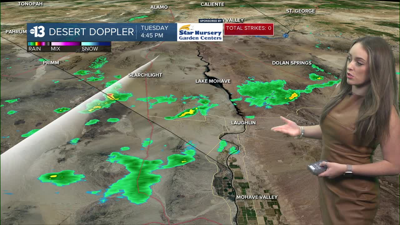
Our first dose of monsoon moisture has arrived to the region, with Desert Doppler picking up slight organization of showers and t-storms south of 1-15 as of 5:30pm. Laughlin is the only community in Southern Nevada at this hour tracking some spotty precipitation potential. However, later into the evening the organization of this system will push north closer to Boulder City, Henderson and Las Vegas bringing a slight chance of showers to the metro area between 12am and 5am. A stray t-storm could also develop which could bring dry lightning and gusty winds.
Between 6am and 12pm, our chance of rain increases to 40% in the Las Vegas valley as a strong band of moisture is set to roll through. Much of any precipitation that develops may evaporate due to the warm and dry conditions locally...but we could still see a few sprinkles. Stray t-storms will continue to have a chance of developing. In the afternoon hours, this system will push east and our rain chances will drop. We will see if we'll be able to break our 100+ dry streak at the airport with this system.
Prepare for gusty winds to finish out our work week — especially in the afternoons with gusts up to 30mph Wednesday, Thursday and Friday. Temps are set to drop back to the 90s Saturday Sunday.
Watch: How could El Nino impact the weather in Las Vegas?
