

TONIGHT: Cloudy. S Wind 5-10mph. Low: 48°
PRESIDENTS DAY: Mostly cloudy. Windy with SW 17-22mph sustained winds, gusts up to 32mph. 80% pm rain. High: 68°
TUESDAY: Mostly sunny. Breezy with SW 15-20mph sustained winds, gusts up to 32mph. High: 62°
A potent low-pressure system is moving into the Pacific Southwest and will make things feel a little more like winter locally. Cooler temperatures, wind and rain are on tap this week.
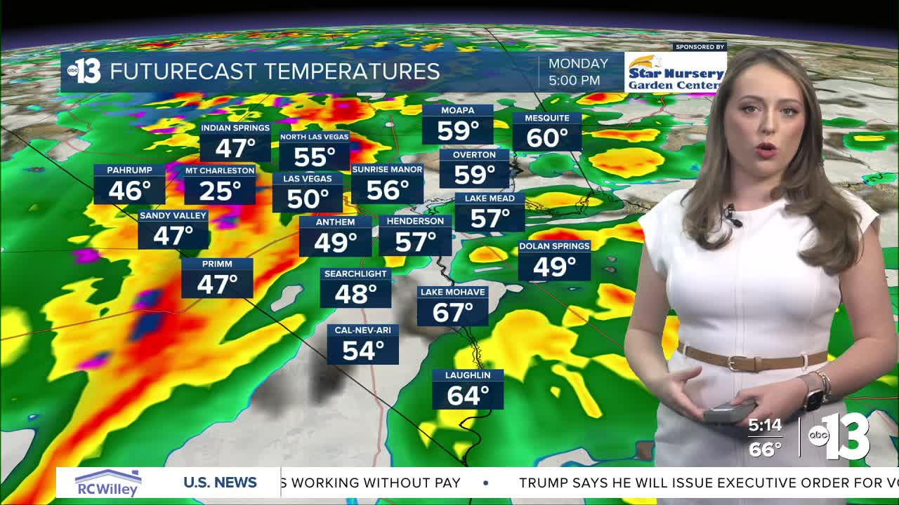
We're tracking our first round of active weather Monday — Presidents Day — as rain chances ramp up to 80% in Southern Nevada in the afternoon. Strong southerly winds up to 30mph with occasional gusts up to 45mph are also expected in Clark County. We'll see some much needed snow in the mountains with this system.
Winter Storm Warnings have been issued for the Spring Mountains and Sheep Range above 5,000ft from Monday morning at 10AM through Wednesday evening. Up to a foot of snow is expected to accumulate through Wednesday with gusty conditions and icy roads. Central Nye County and Nye Counties have also been upgraded to be included with this alert as snow will fall above 5,000 feet in these areas.
Wind Advisories have been issued across the region including for most of Clark County, Southern Nye, Mojave and San Bernardino Counties. and the surrounding region beginning at 10AM Monday. South winds 20-30mph with gusts up to 45mph could bring dangerous crosswinds, tree damage, power line damage and danger for small crafts on waterways.
Rain chances drop Tuesday and then ramp up again Wednesday with an additional round of low pressure.
Temperatures will drop back into the 50s in Las Vegas by Wednesday, which is below average for this time of year.