

TONIGHT: Mostly cloudy with a 20% chance of showers. Winds: Light & variable. Low: 87°
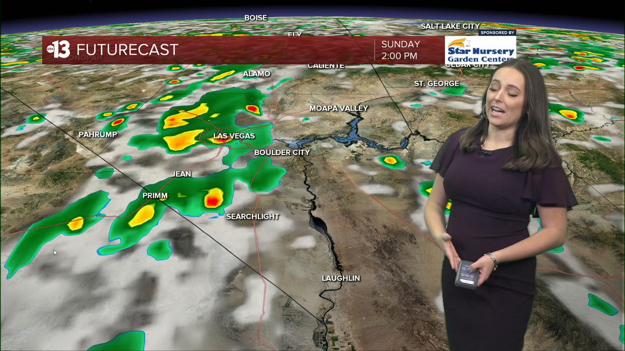
SUNDAY: Partly cloudy with a 40% Chance of scattered showers and storms starting 3pm. Winds: W SW 5-10 mph. High: 104°
MONDAY: Partly cloudy with a 50% chance of scattered showers and storms. Winds: S 5-10 mph. High: 103°
Monsoon has returned! Muggy and mostly cloudy with isolated t-storms in the region...though showers are not widespread and have not yet reached the Las Vegas metro area by Saturday evening. Still, Las Vegas will see a 20% chance of showers overnight. The Extreme Heat Warning expires in Clark County at 11PM.
On Sunday, we'll see similar temps to Saturday with a high temperature of 103° in the afternoon hours. Humidity levels are up so it will continue to feel uncomfortable outside despite temps not being as hot. In the afternoon, we'll see an uptick of storm potential — about 40%.
We'll start out the work week with similar conditions Monday but the real impact hits Tuesday. Temperatures return to the 90s and stay that way through the remainder of the work week. We'll also continue to track monsoon storms through Thursday. Important to remember - this is not a washout system and rain will be hit or miss in the area. However, storm potential will mean possible strong outflow winds, heavy rain, and possible urban flooding.