

TONIGHT: Cooling off into the mid to upper 60s with mostly clear skies across the region
TOMORROW: Temperatures start to climb once again, back into the mid 90s with lots of sunshine
THIS WEEK: Extreme heat not going anywhere, with high temps in the 90s and low temps in the mid to upper 60s all week long
________________________________________________________
If I'm starting to sound like a broken record (pun intended), it's because we can't stop breaking high temperature records in Las Vegas!
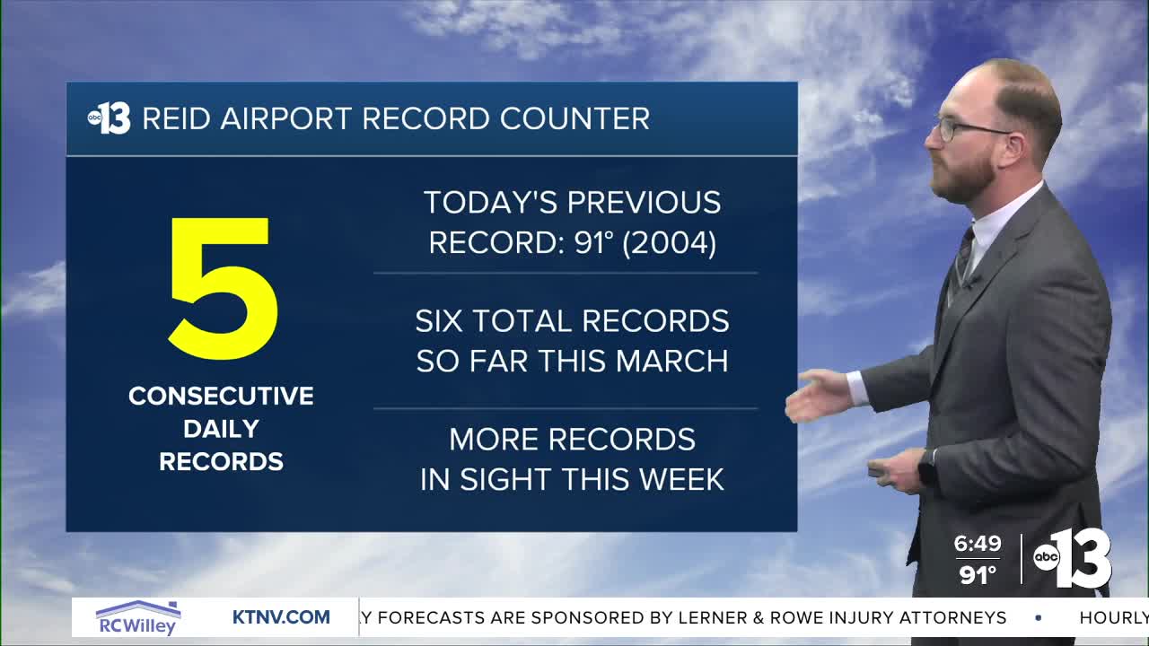
Sunday was a few degrees cooler than we've seen over the last several days, but it was still hot enough to mark our fifth straight daily high temperature record: 93° at Reid Airport today replaces the previous record of 91° set in 2004.
It's the sixth record we've broken this March overall (we also set a record on March 1), and several more records will be falling as we roll into the work week.
Even though the Extreme Heat Warning for Southern Nevada has expired, that doesn't mean we're done with the extreme heat — quite the opposite, in fact.
Temperatures around the region return to the mid 90s on Monday — with a forecast high of 95° at Reid Airport — and will continue to climb into the upper 90s by Wednesday, when we're forecasting 97° as of now.
We'll stay in the 90s all the way through Friday, breaking a record every day, with a chance to dip into the upper 80s a week from today, even though 89° next Sunday would still tie a record.
Overnight low temperatures will be in the mid 60s all week which will thankfully give us some relief from the continuing early-season extreme heatwave.
As you return to work and the kiddos go back to school tomorrow, it's all the more important to make sure you and your family bring plenty of water with you, as the scorching temperatures continue to dominate our weather forecast!
Stay cool out there!
