

MORNING: Cool readings in the mid-and-upper 60s early today. Morning sun with light breezes at 5-15 mph.
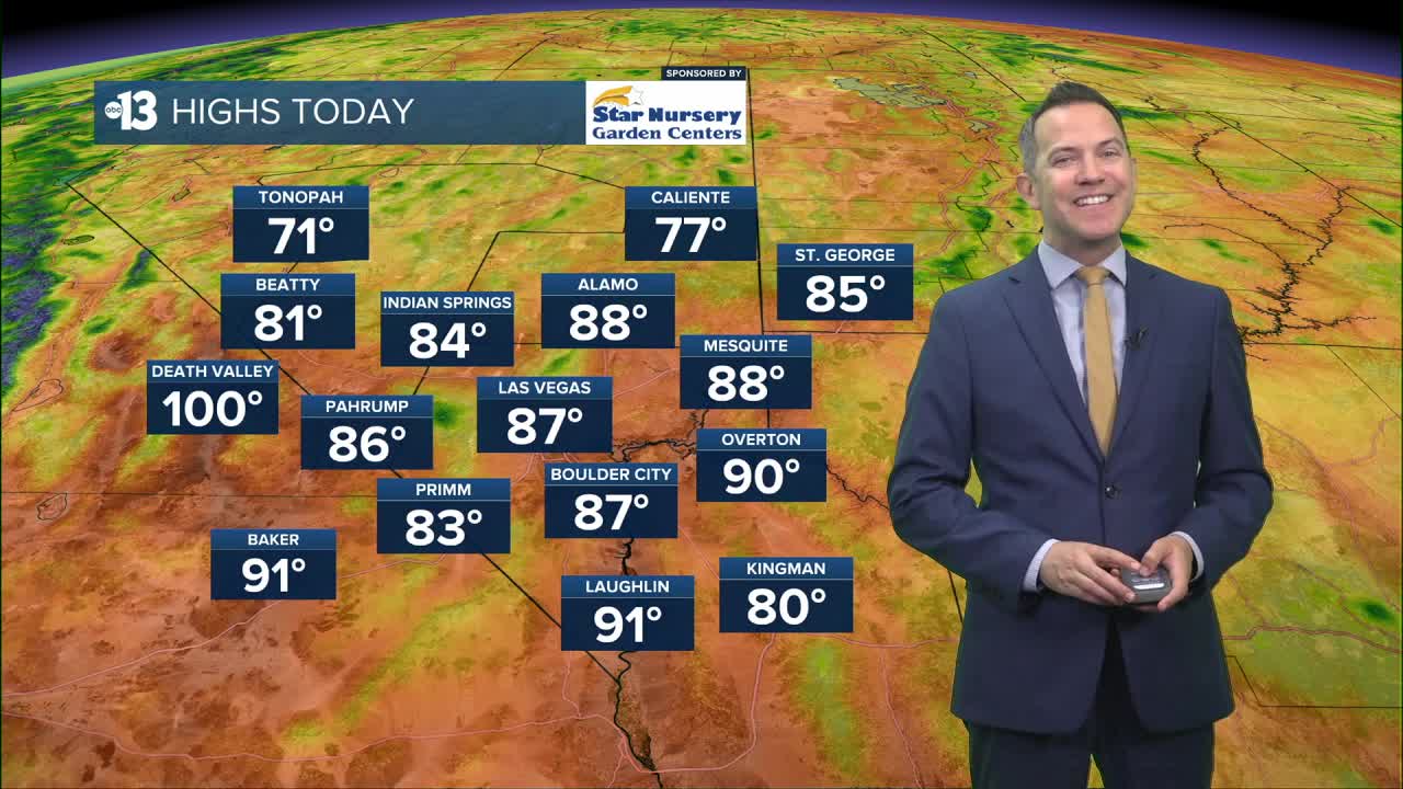
AFTERNOON: Highs in mid 80s with humidity and mostly sunny conditions.
TONIGHT: High clouds increase tonight as lows drop to the low 70s.
High temperatures reach the upper 80s Tuesday as southwest winds pick up to 15-25 mph in the afternoon. Highs reach near 90° Tuesday through Thursday, then trend back to the mid 80s for the weekend. There are hints that cooler highs in the upper 70s may arrive early next week.

Dry conditions cover Southern Nevada all week. Nighttime and early morning low temperatures during this period will be pleasant, in the mid-and-upper 60s.
We saw quite a bit of active weather over the weekend, including a land spout near Cal-Nev-Ari. We had a number of people reach out to us asking if what they were seeing was a tornado.
Justin Bruce breaks down the differences between the two.
Don't forget the sunscreen if you're out enjoying the weather; the UV index is "high" from 11 a.m. to 2 p.m. (sunburn in 30 minutes). Sunscreen, a broad hat, and light-colored, lightweight clothing are smart if you're outside for any length of time between 9:00 a.m. and 4:00 p.m.
The forecast pollen levels are "medium" today and tomorrow, with ragweed, chenopods, and sagebrush listed as the predominant pollen types, but slight relief is possible midweek as levels drop to the "low-medium" category.
The air quality forecast is "good" the next couple days.
