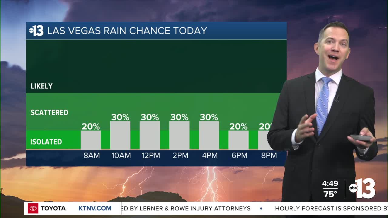


MORNING: Readings in the 70s with a partly cloudy sky and a 20% chance of pop-up showers and thundershowers.
AFTERNOON: Humid highs in the upper 80s with a 30% chance of showers and thundershowers along a mix of clouds and sun.
TONIGHT: Readings in the 70s after sunset with a 20% chance of passing showers and thundershowers; lows in the low 70s late.
Rain and storm chances climb from 20% Saturday morning to 50% from midday through afternoon. Highs limited to the mid 80s with more clouds than sun and noticeable humidity.

Sunday is similar, with a 30% chance of showers and thundershowers as highs reach the mid 80s and monsoon mugginess remains in place.
Humidity lingers Monday and Tuesday although the rain and storm chance is only 10%. Highs will be in the mid 80s with wake-up temperatures in the upper 60s.
Sunny and warmer conditions return for the middle and end of next week, with highs back near 90° starting Thursday and lasting across next weekend.
Nighttime and early morning temperatures next week will be cooler, in the mid 60s.
Don't forget the sunscreen if you're out enjoying the weather; the UV index is "very high" from 11 a.m. to 2 p.m. (sunburn in 15-30 minutes). Sunscreen, a broad hat, and light-colored, lightweight clothing are smart if you're outside for any length of time between 10:00 a.m. and 4:00 p.m.
The forecast pollen levels are "medium" this week, with ragweed, chenopods, and sagebrush listed as the predominant pollen types.
The air quality forecast is "good" the next couple days.
