

AFTERNOON: Sun and some high clouds, highs in the low-to-mid 80s, northeast breezes at 10-15 mph.
EVENING: Sunset is around 6:45 p.m. and we'll drop into the 70s as it gets dark. Partly cloudy conditions with 5-10 mph breezes.
TONIGHT: Lows in the upper 50s and low 60s with high clouds at times.
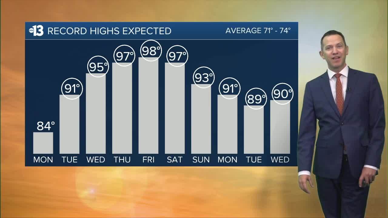
Records will be tied or broken tomorrow through early next week as an intense heat wave impacts Southern Nevada.
Las Vegas sees 91° Tuesday (St. Patrick's Day), 95° Wednesday, 97° Thursday, 98° Friday, 97° Saturday, 93° Sunday, 91° next Monday, 89° next Tuesday, and 90° next Wednesday.
The all-time March record is 93°, so we'll surpass that benchmark several times over. Spring doesn't even officially begin until 7:46 a.m. this Friday!
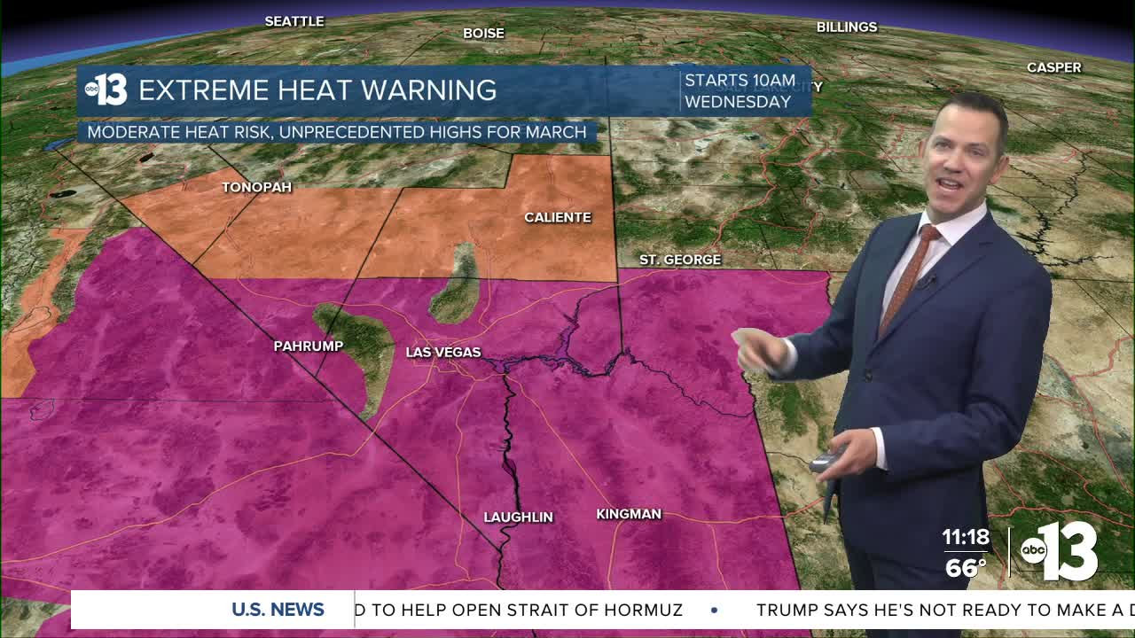
Monday morning, the National Weather Service actually updated our Extreme Heat Watch up to an Extreme Heat Warning, and upped the timeline from Thursday morning to Wednesday, beginning at 10 a.m. The warning has also been extended to 8 p.m. Sunday.
What does the upgrade mean?
An Extreme Heat Watch is issued when conditions are favorable for an extreme heat event. The upgrade means the intensity and duration of the forecast heat has a high degree of confidence of occurring.
During an Extreme Heat Warning, it's advised to avoid outdoor activities, especially during the heat of the day. If you must be outside, be sure to drink plenty of water and take frequent breaks in the shade. Stay indoors in an air-conditioned space as much as possible, including overnight. Check on family and neighbors.
The heat risk product the National Weather Service uses to issue these products shows that on Thursday, Friday, and Saturday, the Las Vegas valley will experience "moderate" heat risk, which means those who are sensitive to heat, especially those without cooling/hydration, will experience negative effects, which may impact some health systems and industries.

Lows at night will be milder this week; plan on low 60s Monday night and mid-to-upper 60s Tuesday night through the weekend into early next week.
Forecast pollen levels are "extreme" this week. Across the valley, mulberry, ash, and elm are the predominant pollen types. Showering and changing after you've been outdoors, keeping windows closed when it's windy, and vacuuming and dusting more often will help, in addition to taking allergy medication.
The UV index is "high" from noon through 2 p.m., meaning a sunburn could happen in 30 minutes, so grab a hat and sunscreen if you're outside from mid-morning to mid-afternoon (10 a.m. to 4 p.m.).
The air quality forecast is "good" today and "moderate" the rest of the week due to particle pollution, which tends to accumulate when we have light winds and warm days.
