

MORNING: Partly cloudy with upper 80s and low 90s early, but up near 100° after 10 a.m.
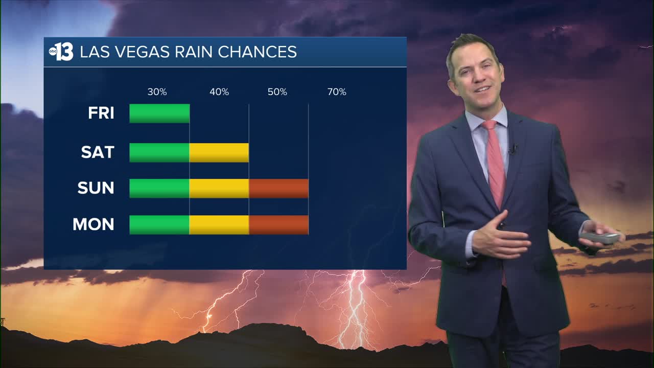
AFTERNOON: Highs near 110° by 5 p.m., which would tie the record for the date, set in 1939. Expect a mix of clouds and partial sun as a 30% chance for showers and storms develops. Although downpours will be few and far between, some Las Vegas neighborhoods may see lightning and gusty outflow winds.
TONIGHT: Temperatures won't drop to the 90s until 9 or 10 p.m., and lows only drop to near 90°. There's a 20% chance for a shower or thundershower this evening and tonight.
An Extreme Heat Warning continues through 11 p.m. Saturday as the heat risk remains "major" and anyone outside without water and shade could feel impacts.

Updated rain and storm chances as a monsoon pattern develops and remains in place around the Desert Southwest: 40% Saturday, 50% Sunday and Monday, 70% Tuesday, 50% Wednesday, and 40% Thursday.

Highs are near 105° this weekend and despite being mostly cloudy, the uptake in humidity will keep the heat oppressive. Highs near 100° on Monday may be limited to the 90s on Tuesday, Wednesday, and Thursday.
Nighttime lows will be warm, in the mid-80s to near 90° this weekend.
Although clouds will be on the increase as rain chances proliferate, the UV index is still "very high" from 11 a.m. to 2 p.m. (sunburn in 15 minutes). Sunscreen, a broad hat, and light-colored, lightweight clothing are smart if you're outside for any length of time between 9:00 a.m. and 4:00 p.m.
The forecast pollen levels are "medium" this week, with ragweed, chenopods, and grass listed as the predominant pollen types.