

MORNING: Partly cloudy with readings in the low-to-mid 50s and north breezes at 5-10 mph. Gusts near 20 mph in north parts of Las Vegas valley.
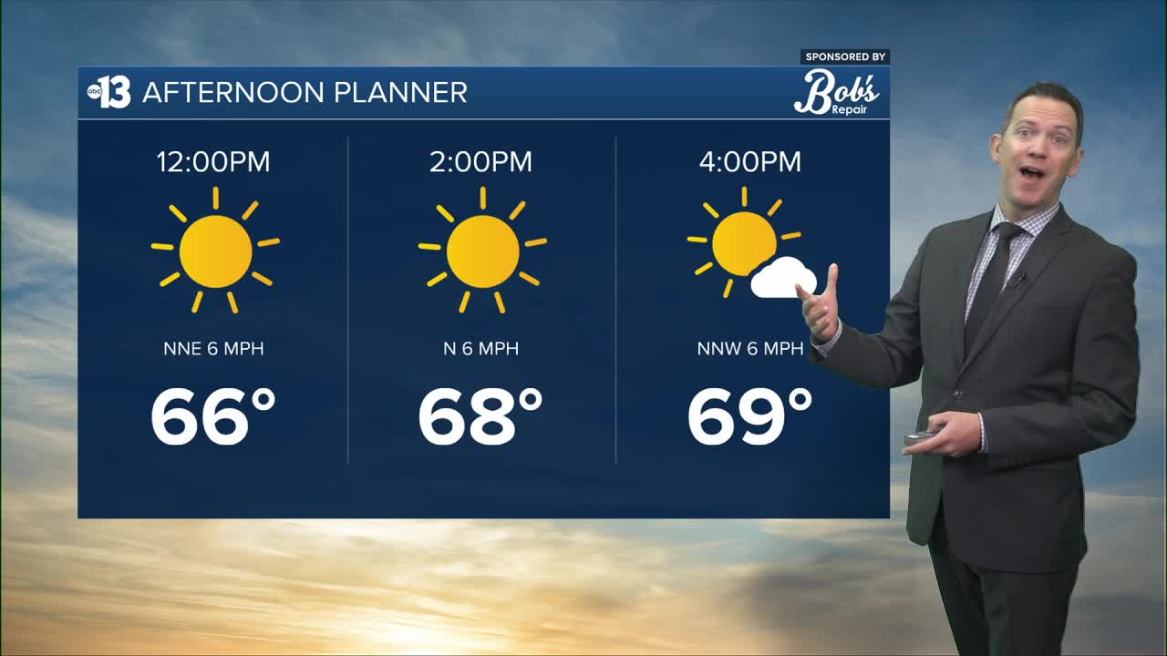
AFTERNOON: Mostly sunny with highs in the upper 60s and north winds at 5-15 mph.
EVENING: Mainly clear with light winds at 5 mph and readings falling to the 50s by 8 p.m.
TONIGHT: Clear and calm and chilly, with lows in the low-to-mid 40s.
Valentine's Day is Saturday! It starts with sun and chilly readings in the 40s and 50s. The sky turns partly cloudy in the afternoon as highs reach 70° with southeast breezes at 10-15 mph.
Sunday is mostly cloudy and breezy, with south winds at 15-20 mph and afternoon readings near 70°.

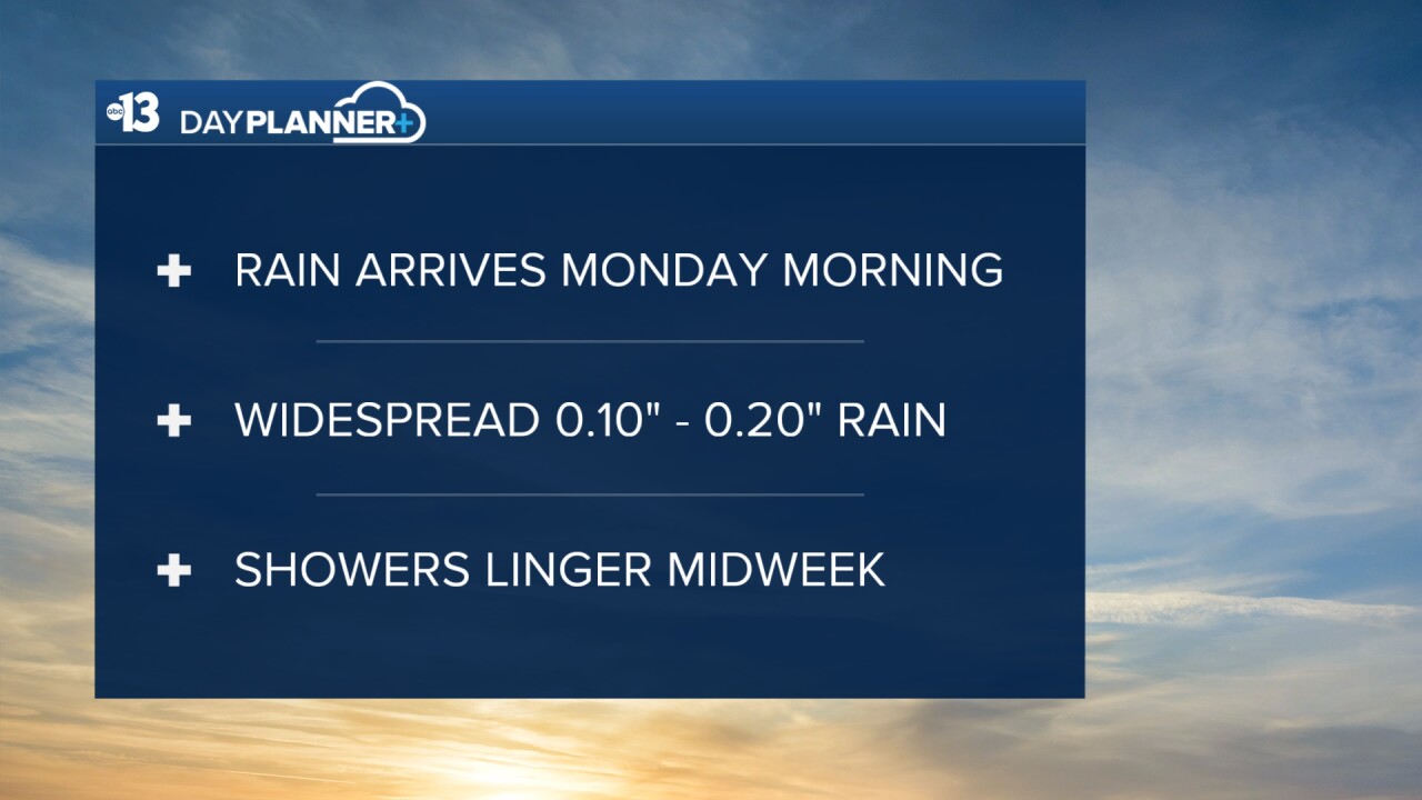
It's safe to say winter is not done with Las Vegas just yet: Monday only reaches 64° as an 80% rain chance develops by late morning and lasts into the afternoon. A widespread 0.10" to 0.20" could fall across Southern Nevada. South winds are forecast to blow at 20-30 mph.
Tuesday and Wednesday see additional shower chances (40% and 50%, respectively) as snow showers continue in the mountains. While rain may mix with the snow on Monday, snow levels will fall below 7,000 feet and around 1 to 2 feet of snowfall looks likely for Lee Canyon and Mt. Charleston by midweek!
Down in the valley, Tuesday is very windy with southwest winds from 20-35 mph. Highs will be near 60° with a partly cloudy sky and the aforementioned 40% shower chance.
Wednesday sees a better 50% shower chance around Las Vegas; highs will be limited to the upper 50s as west breezes blow at 15-20 mph.
Thursday looks dry and mostly sunny with 10-15 mph west breezes and highs in the upper 50s.
Friday and Saturday are mostly sunny with highs in the upper 50s and fairly light breezes.
Nighttime lows will be in the 40s Friday night through Tuesday night, and then Wednesday night through next Friday night will see lows in the upper 30s.
The air quality forecast is "good" for the next few days.
The forecast pollen levels climb from "medium" to "medium-high" this weekend, with ash and juniper listed as the predominant pollen types.
Even though it's winter, the UV index is "moderate" from 10 a.m. through 1 p.m., meaning a sunburn could happen in 45 minutes for some people, so grab a hat if you're outside for that long from late morning through early afternoon.