

MORNING: Mostly cloudy with readings in the low-to-mid 50s and south breezes at 5-10 mph.
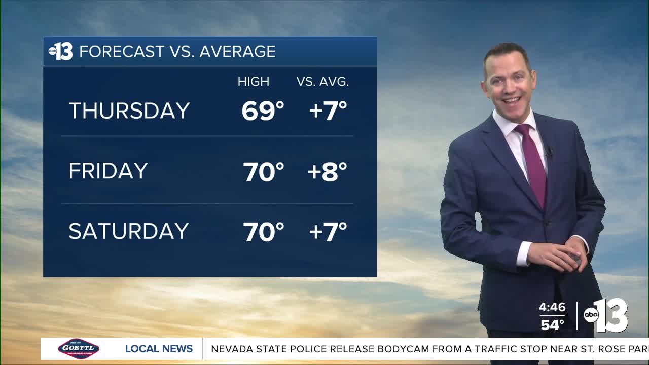
AFTERNOON: Partly cloudy with highs in the upper 60s and light northeast winds at 5-10 mph.
EVENING: Partly cloudy with light winds at 5 mph and readings falling to the 50s.
TONIGHT: Partly cloudy with light winds and lows near 50°
Friday is mostly sunny with north winds at 5-15 mph and highs near 70°.
Valentine's Day is Saturday! It starts with sun and chilly readings in the 40s and 50s early. The sky turns partly cloudy in the afternoon as highs return to 70° with southeast breezes at 10-15 mph.
Sunday turns mostly cloudy and breezy, with south winds at 15-25 mph and afternoon readings in the upper 60s.
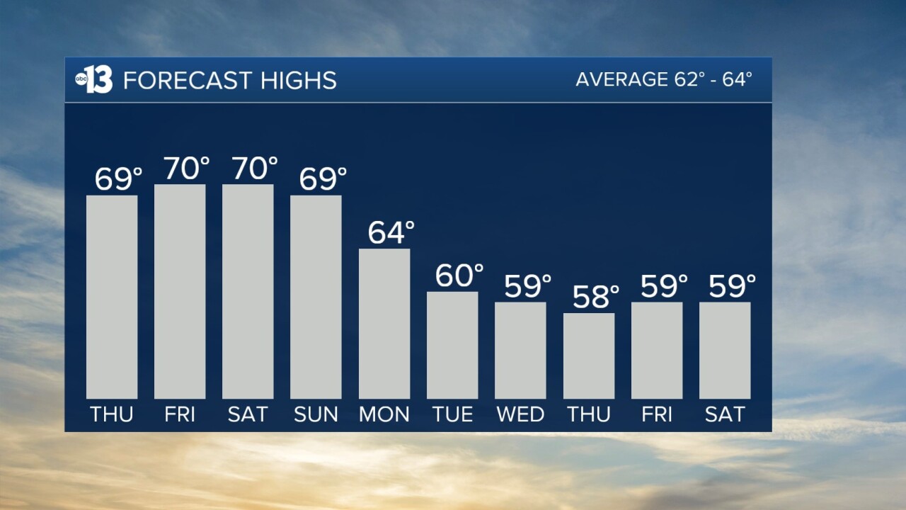
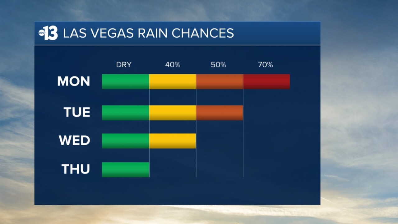
It's safe to say winter is not done with Las Vegas just yet: Monday only reaches 64° as a 70% rain chance develops from daytime through evening. Also, southwest winds are forecast to hit 15-30 mph.
Tuesday and Wednesday see additional rain chances (50% and 40%, respectively) with highs between 59° and 60°. Tuesday is still windy (southwest 20-30 mph) but Wednesday's breezes are more manageable at 15-20 mph.
Thursday looks dry, but still breezy (south 15-25 mph) as highs remain in the upper 50s.
The air quality forecast is "good" for the next few days.
The forecast pollen levels climb from "medium" to "medium-high" this weekend, with ash and juniper listed as the predominant pollen types.
Even though it's winter, the UV index is "moderate" from 11 a.m. through 1 p.m., meaning a sunburn could happen in 45 minutes for some people, so grab a hat if you're outside for that long around midday.