

MORNING: Clear with wake-up temperatures in the 70s and calm conditions.
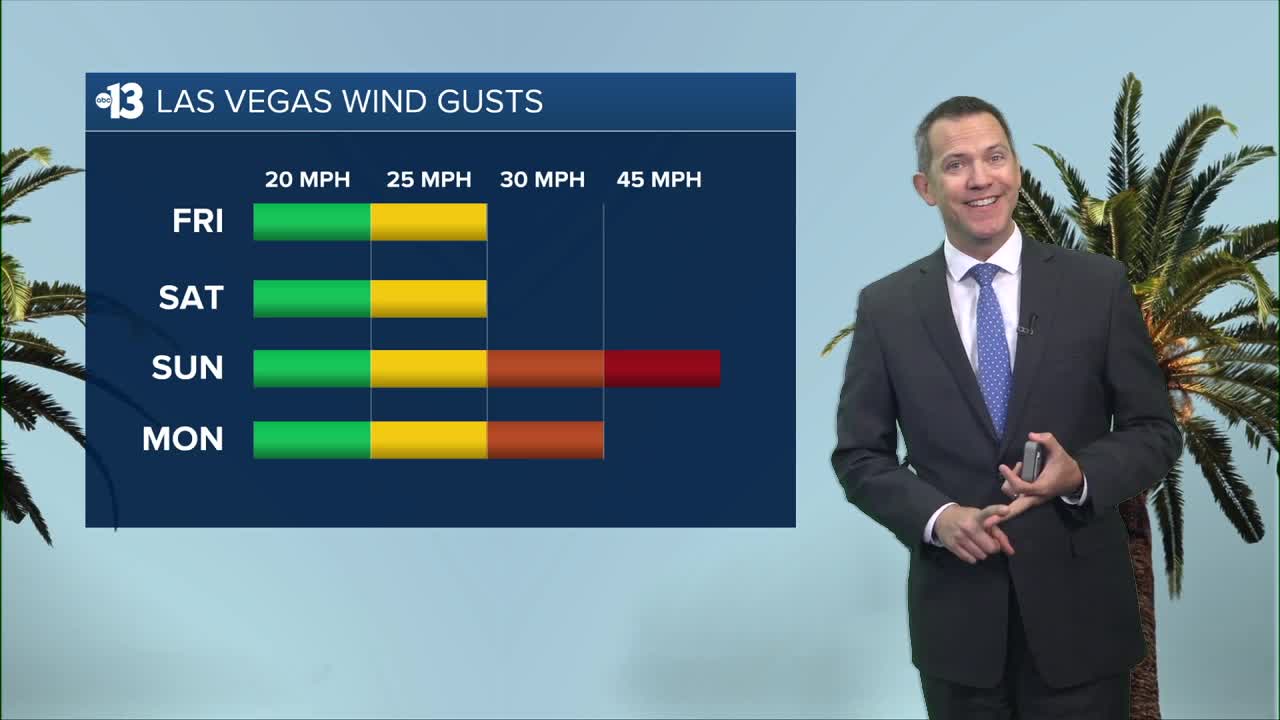
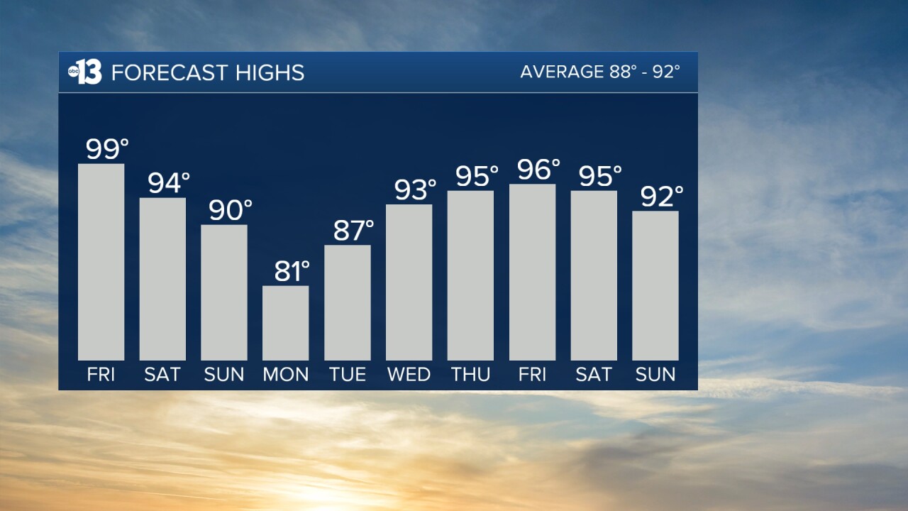
AFTERNOON: Sunny with highs in the upper 90s to near 100° and southwest winds of 15-25 mph.
EVENING: Clear with lingering breezes at 15-20 mph and temperatures in the 80s after 8 p.m.
TONIGHT: Lows in the low 70s with continued southwest breezes at 15-20 mph.
Mid-90s are expected Saturday as southwest winds at 10-20 mph in the morning increase to 15-25 mph in the afternoon alongside mostly sunny conditions.
Sunday is very windy, and a High Wind Watch is in place from 11 a.m. through Sunday night. Gusts from the southwest may hit 45 mph in the early afternoon, when highs approach 90°.
Sunday night sees north gusts of 30 mph and low temperatures in the low 60s.
Monday morning sees north winds at 20-30 mph and chilly temperatures in the 60s. Winds die down in the afternoon as highs are limited to the low 80s in spite of sunshine.
Readings start in the low 60s Tuesday before climbing to the mid 80s in the afternoon, and we'll enjoy light breezes and sunshine.
Highs are in the mid 90s the rest of next week with calm conditions and mostly sunny weather.
Forecast pollen levels are "medium" the next four days, with ragweed, olive, and grasses listed as the predominant pollen types. Showering and changing after you've been outdoors, keeping windows closed when it's windy, and vacuuming and dusting often will help battle symptoms, in addition to taking allergy medication.
The air quality forecast is "unhealthy for sensitive groups" today and "moderate" tomorrow, due to ozone.
The UV index is "high" to "very high" from 10 a.m. through 3 p.m., when a sunburn could happen in 15 to 30 minutes. Sun protection is advised between 9 a.m. and 5 p.m. today; a hat, light-colored clothing, and sunscreen are important when you're outside.
