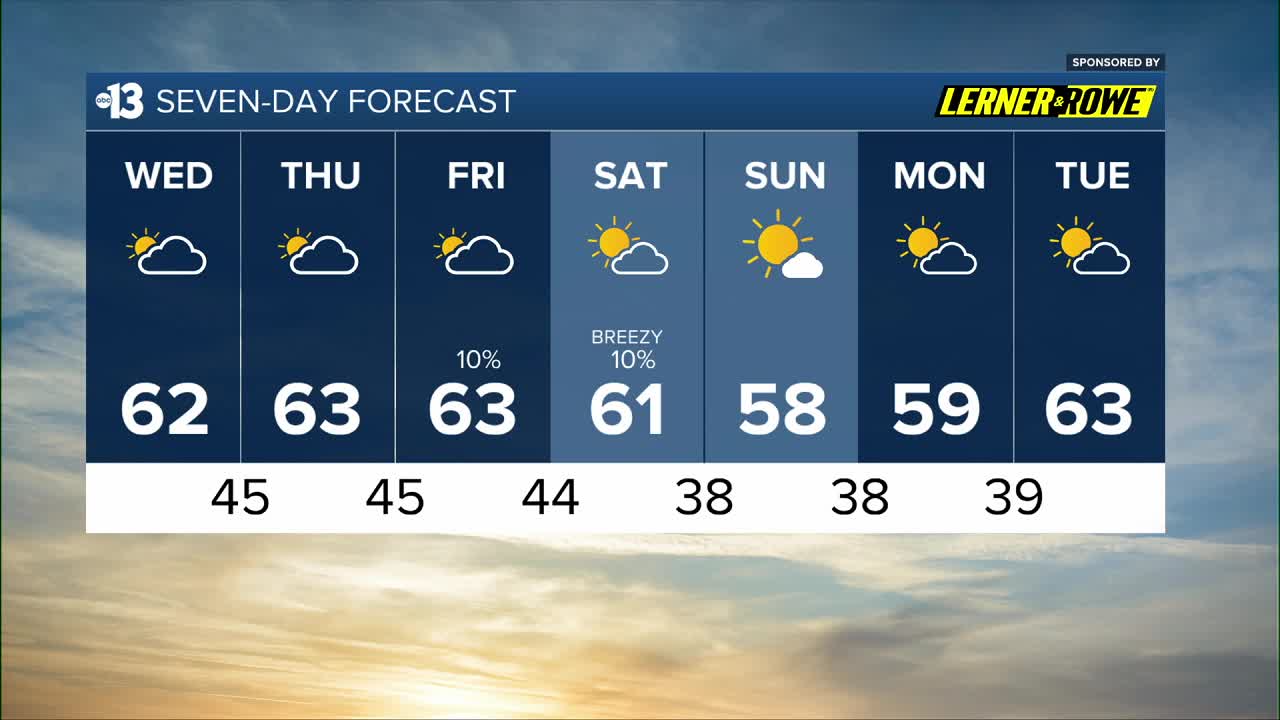


MORNING: High clouds thicken up. Chilly wake-up temperatures in the upper 30s and the 40s.
AFTERNOON: Mostly cloudy with highs in the low 60s and light winds of 5 mph.
EVENING: Mostly cloudy with 50s dipping to the 40s after 9 p.m.
TONIGHT: Lows in the mid 40s with a mostly cloudy sky.
Mostly cloudy conditions continue tomorrow, and Friday, keeping highs in the low 60s the rest of the week.
A weather system swirls from the coast of Southern California across the southern tier of the United States between Thursday and early next week, generating a major winter weather system for millions of people in the Central and Southern Plains, the Southeast, the Midwest, the Mid-Atlantic, and the Northeast.
That system will bring the chance of a few spotty showers to Las Vegas Thursday night through Friday morning (10% chance) with a slightly better chance Friday afternoon through the wee hours of Saturday morning (20% chance).
North winds at 10-20 mph on Saturday in the wake of that system bring in drier air and afternoon sunshine, but highs remain near 60°.
Saturday night through Sunday morning falls to the upper 30s, and Sunday afternoon won't escape the upper 50s in Las Vegas despite being mostly sunny.
Similar chill is expected Sunday night into Monday morning (upper 30s) with highs limited to the upper 50s again on Monday afternoon.
Las Vegas climbs back to the mid 60s by the middle of next week, and flirts with 70° next weekend!
