

MORNING: Mostly sunny and cooler than it has been; wake-up temperatures are in the 70s.
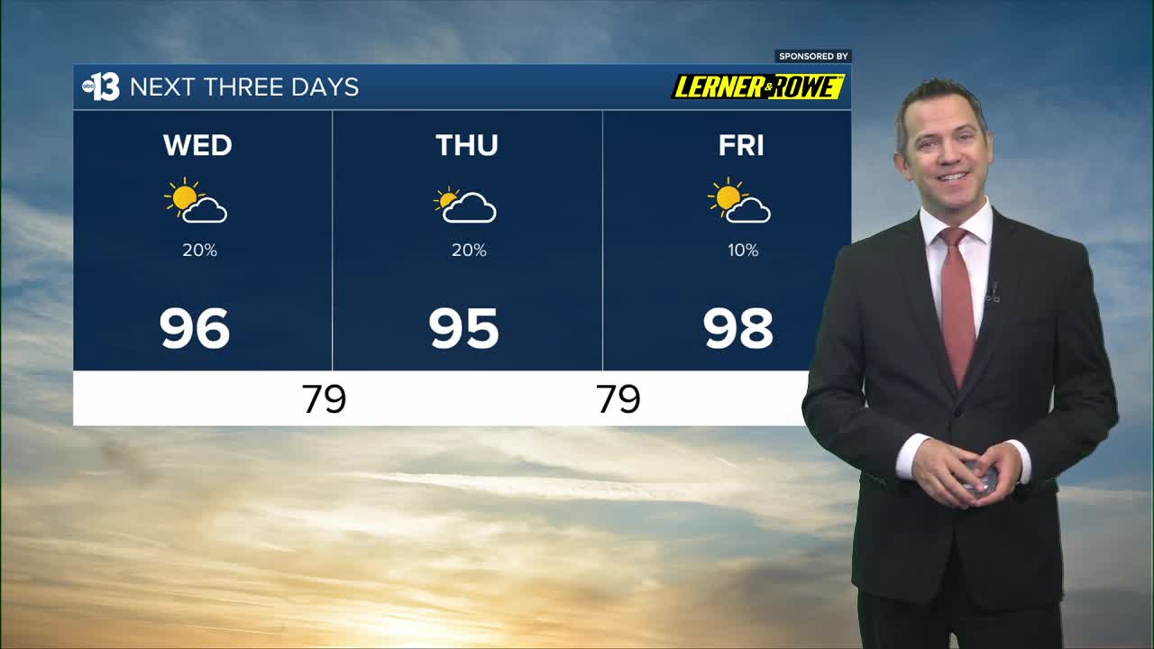
MIDDAY: Partly cloudy, with a 20% chance of an isolated thunderstorm. Highs return to the mid 90s.
THIS EVENING: Falling to the low 90s after sunset, lows in the upper 70s late.
Highs trend from the mid 90s Thursday, with a mostly cloudy sky, and another minor rain chance (20%).

Friday heats up to 98° with a lingering 10% rain chance. The weekend looks mostly sunny and is even hotter, near 100° Saturday and 102° Sunday. Readings near 100° early next week are close to average for late August.
Minor pop-up storm chances on Labor Day (20%) and Tuesday as highs range from 102° to 100°.
When it's not stormy or cloudy, the UV index is still "very high" from 11 a.m. to 2 p.m. (sunburn in 15 minutes). Sunscreen, a broad hat, and light-colored, lightweight clothing are smart if you're outside for any length of time between 9:00 a.m. and 4:00 p.m.
The forecast pollen levels are "medium" this week, with ragweed, chenopods, and grass listed as the predominant pollen types.
