

MORNING: Partly cloudy with 70s and 80s early, and 90s by 10 a.m.
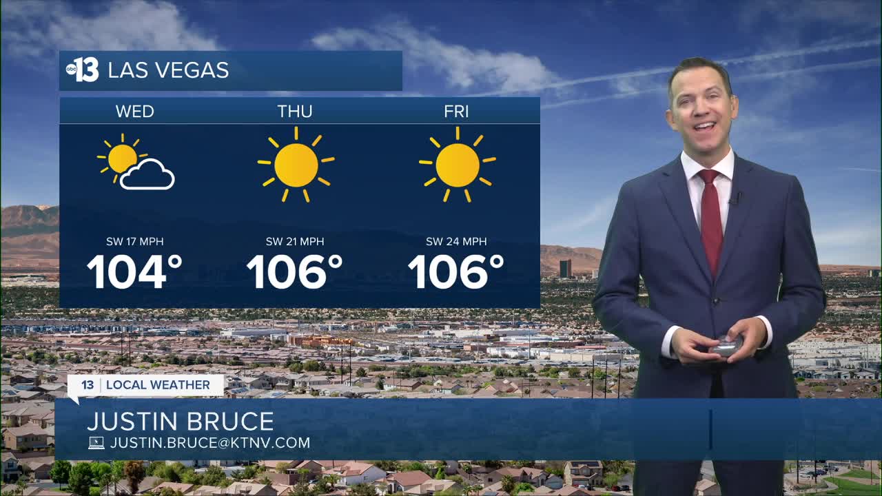
AFTERNOON: High of 104° with mostly sunny conditions and southwest breezes at 10-20 mph.
EVENING: Southwest breezes at 10-15 mph with readings in the 90s.
TONIGHT: Lows in the mid 70s with some 5-10 mph breezes.
Highs reach 106° Thursday and Friday, which will be the hottest of 2026. The heat risk rises to the "major" category then, meaning even healthy people can suffer if they don't have access to water and shade.
Late night and early morning lows will be in the 70s through the weekend.
Maximum winds will be near 20 mph today and 25 mph on Thursday and Friday. Gusts hit 35 mph Saturday, and linger at 30 mph Sunday and Monday.
Highs dip slightly to the upper 90s Sunday, Monday, and Tuesday before rising above 100° for the rest of next week. There are signs that highs may range from 105°-110° by the middle of June.

The air quality forecast is "unhealthy for sensitive groups" today and tomorrow due to ozone.
Forecast pollen levels are "medium" with ragweed, grasses, and oak listed as the predominant pollen types. Showering and changing after you've been outdoors, keeping windows closed when it's windy, and vacuuming and dusting often will help battle symptoms, in addition to taking allergy medication.
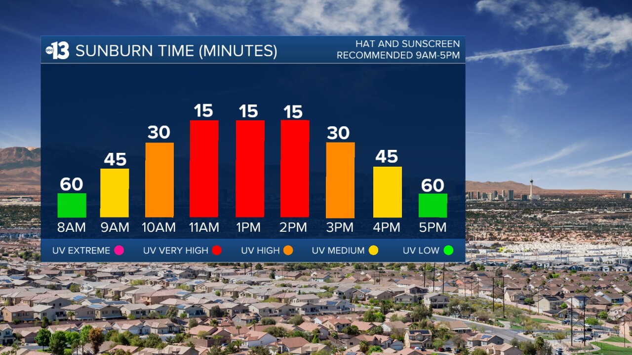
Sun protection is advised between 9 a.m. and 5 p.m.; a hat, light-colored clothing, and sunscreen are important when you're outside. The UV index is strongest from 10 a.m. through 3 p.m., when a sunburn can happen in 15 to 30 minutes.