

MORNING: Mainly sunny with wake-up temperatures in the mid 30s to low 40s.
AFTERNOON: Mainly sunny with highs in the low 60s and light winds.
EVENING: Turning partly cloudy with readings falling to the 40s by 8 p.m.
TONIGHT: Partly-to-mostly cloudy with lows in the low 40s.
Wednesday starts cold, in the low 40s, and sees afternoon highs back in the low 60s despite thicker high clouds.
Thursday sees an uptick to the mid 60s with a mostly sunny sky and breezes at 5-15 mph.
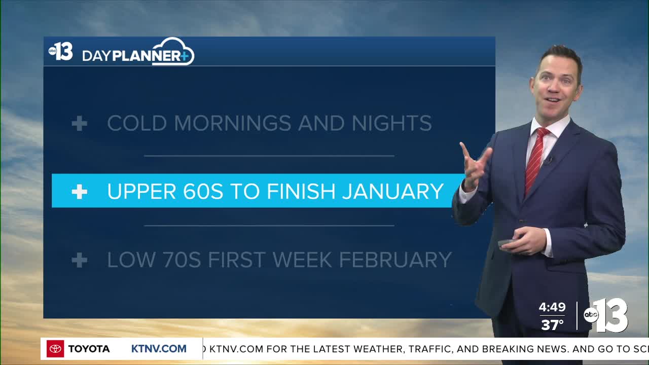
Friday and Saturday bring highs in the upper 60s, which is well above-average for the last couple days of January. There will be a few 5-15 mph breezes each day.
Nighttime lows will be in the mid 40s during this stretch.
Sunday looks partly-to-mostly cloudy, but a mild start to February is expected as we return to the upper 60s.
A stretch of low 70s is most likely starting Tuesday of next week, and is expected to continue after that toward the middle of February.

The air quality forecast is "moderate" this week due to particle pollution.
The forecast pollen levels are "low" over the next four days, with juniper listed as the predominant pollen type.
Even though it's winter, the UV index is "moderate" from 11 a.m. through noon, meaning a sunburn could happen in 45 minutes for some people, so grab a hat if you're outside for that long around midday.