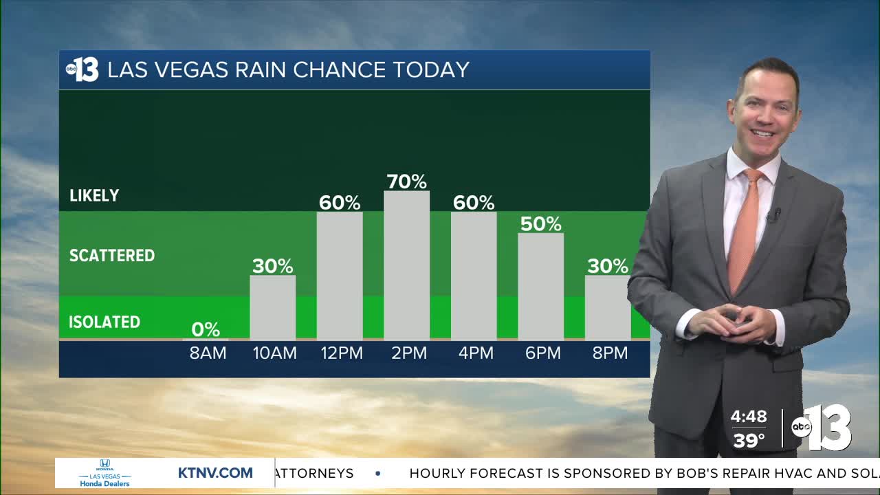


MORNING: After a cold and sunny start in the 30s, clouds increase and rain chances climb to 20% at 10 a.m. and 50% by 11 a.m.
MIDDAY & AFTERNOON: Rain chance climbs to 70% in the early afternoon as our third round of moisture in four days crosses Las Vegas. Highs only touch 50°. Some snowflakes or graupel may be in the mix on the edges of the valley, due to some cold air aloft. Winds pick up from the southwest with gusts of 25 mph increasing to 35 mph toward sunset.

EVENING: A lingering 30% chance of showers (rain mixed with snow) through 10 p.m. as readings hover in the 40s and strong southwest winds blow up to 35 mph.
TONIGHT: Breezes linger at 10-20 mph after midnight as the sky clears and temperatures fall to the mid 30s.
Friday morning starts sunny and cold! Readings in the low-to-mid 30s will feel colder as northwest breezes linger at 10-20 mph at sunrise. We'll turn partly cloudy in the afternoon with a few northwest breezes of 5-15 mph and highs in the mid 50s.
Saturday starts sunny and in the low-to-mid 30s before a partly cloudy afternoon with highs in the mid 50s and northeast breezes at 5-15 mph.
Sunday begins at 40° and highs surge to the low-and-mid 60s in the afternoon as we begin a milder stretch.
A spike to the upper 60s Monday gives way to low-and-mid 70s Tuesday and beyond! Southwest breezes at 10-20 mph and partly cloudy conditions will temper the warm-up just a bit, but the numbers next week are nearly 10° above-average.