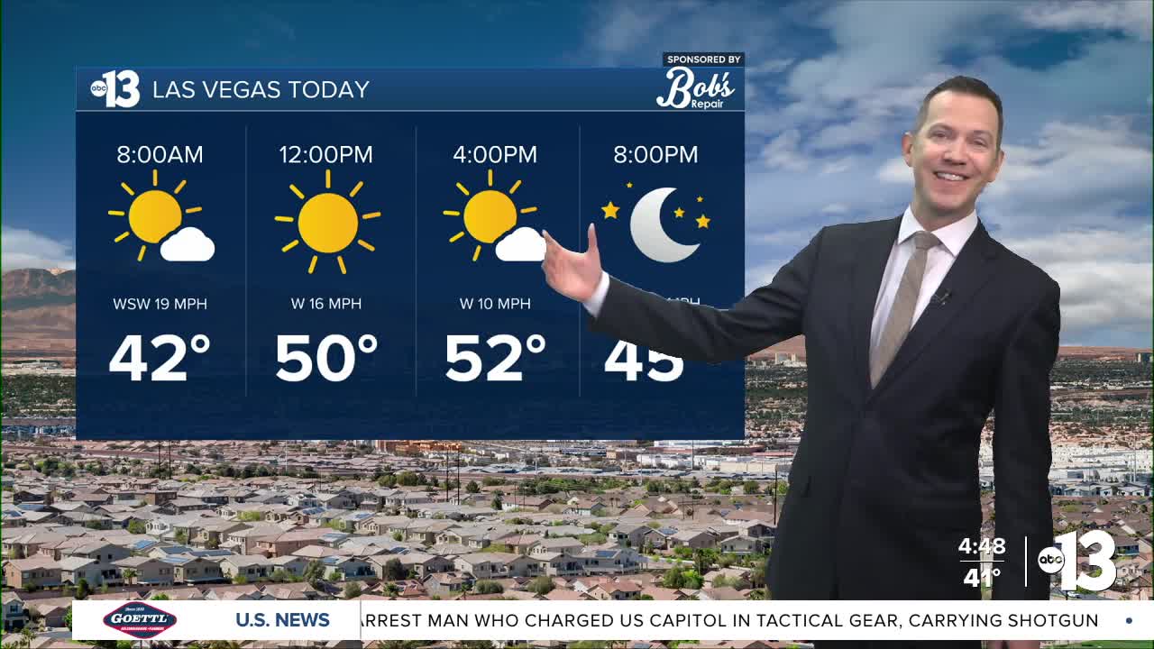


MORNING: A round of rain came through Las Vegas between 1 a.m. and 4 a.m., but streets are drying out quickly at sunrise thanks to the wind. West and southwest gusts of 30 mph make wake-up temperatures near 40° feel like the 30s, so bundle up! You can see that at 6 a.m. the rain is already well east of the valley:

AFTERNOON: Highs remain 10° below-average for mid-February, with Las Vegas only reaching the low 50s. Lingering afternoon gusts of 20 mph will add to the chill. It will stay dry and be mostly sunny.
EVENING: Expect clear conditions and light breezes of 5-10 mph after sunset. Temperatures will tumble into the 40s as it gets dark.
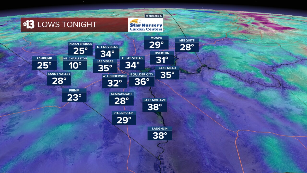
TONIGHT: One of the coldest nights this winter, with lows plummeting to the mid 30s in Las Vegas and the upper 20s in some high elevation neighborhoods on the west side of the valley.
Thursday brings our third round of showers in four days to Southern Nevada. Las Vegas sees a 60% chance develop from late morning through midday into the early afternoon. A 40% chance lingers into Thursday evening. Readings start in the 30s Thursday morning with partly cloudy conditions. Highs only hit the low 50s in the afternoon as south-southwest breezes blow at 15-25 mph with a mostly cloudy sky. Highs in Las Vegas are 13° below-average for the date!

Thursday night sees mid-to-upper 30s with wind chills in the 20s as breezes linger at 10-20 mph under a mostly cloudy sky.
Friday is partly cloudy with a few 10-20 mph northwest breezes and continued cold temperatures. Morning readings in the mid-to-upper 30s will only reach the low-to-mid 50s, still about 10° below-average.
Saturday turns partly-to-mostly cloudy in the afternoon, but breezes are light at 5-15 mph. We'll stay quite chilly, with mid 30s at daybreak rising to the mid 50s in the afternoon.
Sunday is partly cloudy with light breezes at 5-15 mph. Wake-up readings near 40° will reach the low 60s in the afternoon.
A spike to the upper 60s to near 70° arrives Monday and Tuesday and should last through most of next week.