

MORNING: LAS VEGAS (KTNV) — Partly cloudy with temperatures in the 40s.
AFTERNOON: Mostly cloudy with highs in the low 60s and light winds.
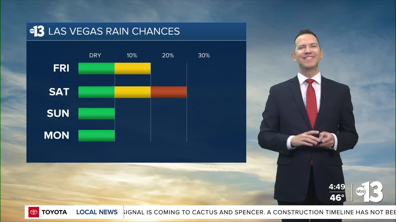
EVENING: Mostly cloudy with a 10% chance of light rain. Readings in the 50s fall to the 40s by 10 p.m.
TONIGHT: Lows in the mid 40s with mostly cloudy conditions and a 20% chance of passing showers, and possibly a rumble of thunder.

A 20% chance of passing showers lingers into Saturday morning, and there may still be a rumble of thunder. Sunshine increases by midday as north winds develop at 15-25 mph and usher in drier air. Highs are limited to near 60° Saturday afternoon, and with the breeze, it will feel chilly.
The air quality forecast has been "moderate" this week due to particle pollution, but should improve Saturday due to those north winds.
Lows in the mid 30s are forecast Saturday night, Sunday night, and Monday night, with upper 30s possible Tuesday night.
Highs are limited to the upper 50s Sunday (mostly sunny) and Monday (partly cloudy) with a return to lighter winds.
Las Vegas climbs to the low 60s Tuesday (mostly sunny) and Wednesday (mostly cloudy), with mid 60s Thursday and Friday.
Upper 60s are expected next weekend as we turn the calendar from January to February.
The weather system swirling south of Nevada today and tomorrow will spark a major winter storm for the rest of the country over the next few days, with debilitating ice and snow across much of the South and East.
The forecast pollen levels are "low" over the next four days, with juniper listed as the predominant pollen type.
