

MORNING: Partly cloudy with a 20% chance for passing showers and temperatures in the 70s.
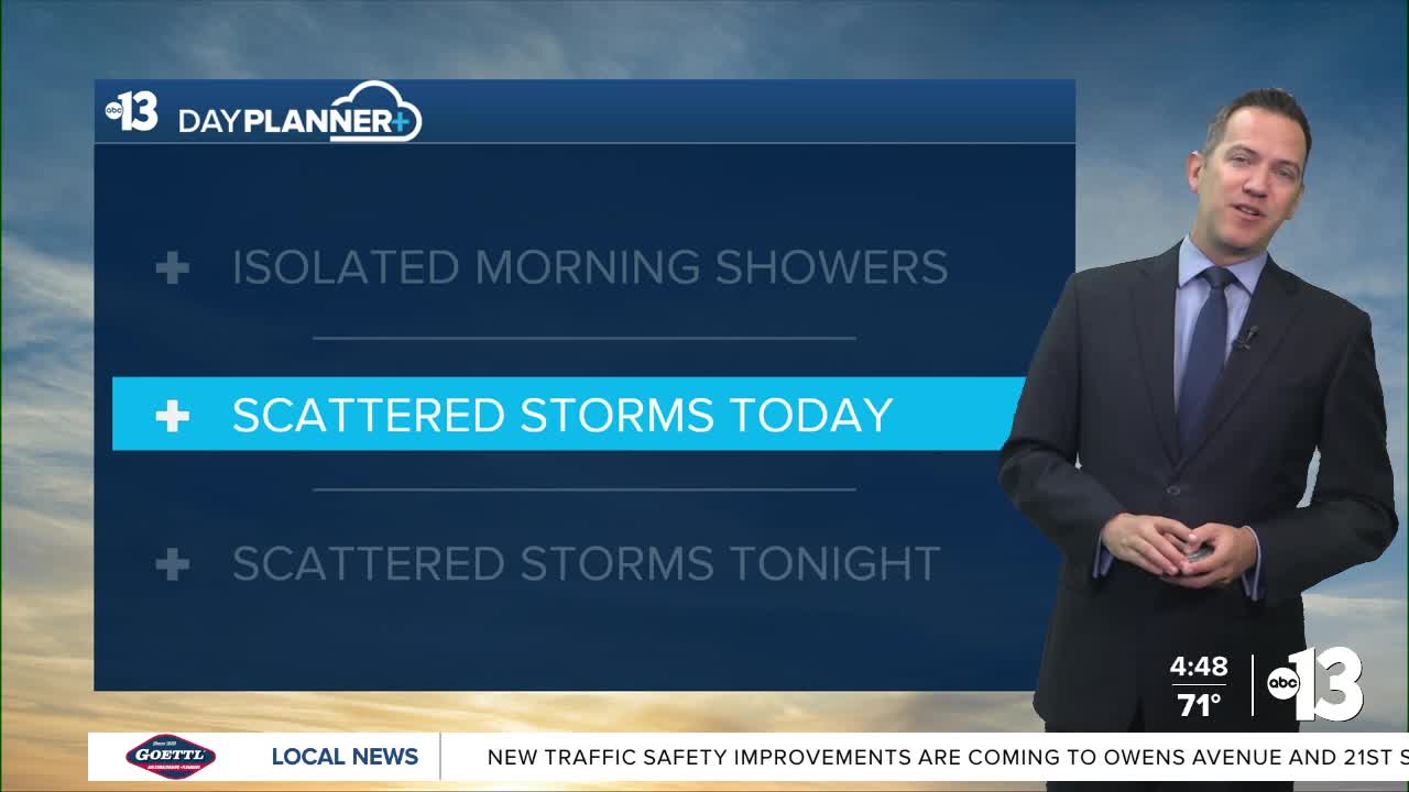
AFTERNOON: Partly cloudy with mid 80s, noticeable humidity, and a 60% chance for thundershowers.
TONIGHT: Partly cloudy with 70s and a 50% chance for thundershowers.
Possible rain totals in Las Vegas today and tonight are between 0.25" and 0.50". The mountains may see 1" of additional rain. A Flood Watch is in place for the Spring Mountains, Lincoln County, parts of Southern California, and much of Utah and Arizona through Saturday.

Rain chances today (60%) and tonight (50%) will fall Saturday (10%).
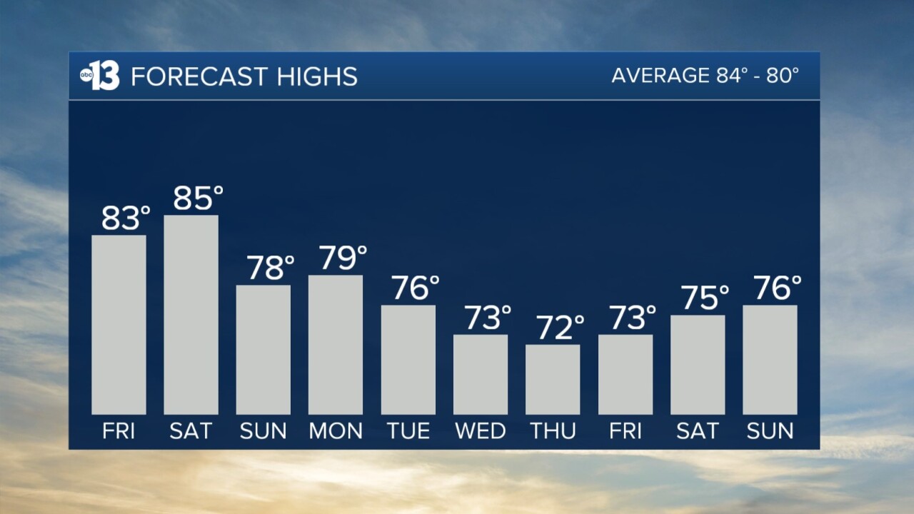
Moisture leaves Southern Nevada Saturday night as a trough of low pressure approaches from Northern California. As a result, we expect a round of 30 mph gusts in Las Vegas for most of Saturday. Highs will reach the mid 80s with a partly cloudy sky.
Sunday marks the beginning of a cooler stretch. Highs in Las Vegas reach the upper 70s Sunday and Monday, the mid 70s Tuesday, and the low 70s Wednesday and Thursday.
While sunshine returns Sunday, a new system approaches from Northern California next week, bringing a slight chance for light rain Tuesday into Wednesday, and dropping highs for Wednesday and Thursday.
Nighttime and early morning lows in the upper 60s tonight drop to the low 60s Saturday night and the upper 50s starting Sunday night. Some neighborhoods will be in the low 50s by the middle of next week.
Even though it's fall, don't forget the sunscreen if you're out enjoying the weather; the UV index is "high" from 11 a.m. to 2 p.m. (sunburn in 30 minutes). Sunscreen, a broad hat, and light-colored, lightweight clothing are smart if you're outside for any length of time between 9:00 a.m. and 4:00 p.m.
The forecast pollen levels are "medium" over the next four days, with ragweed, chenopods, and sagebrush listed as the predominant pollen types. The air quality forecast is "good" in Las Vegas the next couple days.
