

MORNING: Cool and sunny with wake-up temperatures in the 50s and 60s, alongside north breezes at 5-15 mph.
AFTERNOON: Light breezes with sunshine and highs in the upper 70s.
EVENING: Cooling into the 60s by 9 p.m. with light breezes.
TONIGHT: Lows in the mid 50s with light breezes and a partly cloudy sky.
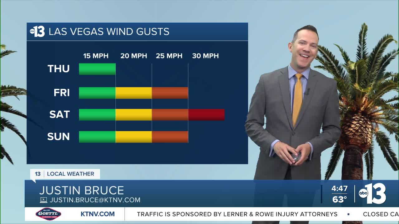
Friday is partly cloudy and 83° (after starting in the 50s and 60s) with southwest afternoon breezes at 15-25 mph.
A blustery weekend is ahead: Saturday sees 30 mph gusts and Sunday sees 25 mph gusts. The breezes are expected from start to finish each day. Partly-to-mostly cloudy conditions on Saturday bring a 20% shower chance and limit highs to the mid 70s. Sunday is partly cloudy with 50s at daybreak and in the low 70s in the afternoon.
Marginal afternoon gusts of 20-25 mph continue next week as highs range from the upper 70s to the low 80s each day through Thursday. A move to the mid 80s kicks in next Friday as we flip the calendar to May.

Forecast pollen levels are "extreme" this week, and ragweed, olive, and grasses are the predominant pollen types. Showering and changing after you've been outdoors, keeping windows closed when it's windy, and vacuuming and dusting more often will help battle symptoms, in addition to taking allergy medication.
The air quality forecast is "moderate" today and tomorrow due to ozone.
The UV index is "high" from 11 a.m. through 2 p.m., when a sunburn could happen in 15 to 30 minutes. Sun protection is advised between 10 a.m. and 4 p.m. today; a hat, light-colored clothing, and sunscreen are important when you're outside.