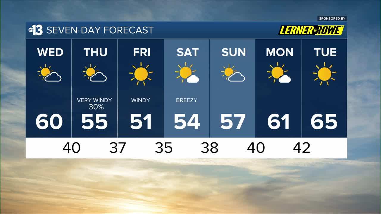


MORNING: Partly cloudy and calm with temperatures in the 40s.
AFTERNOON: Mostly sunny and calm with highs in the upper 50s to near 60°.
EVENING: Partly cloudy and calm with readings falling to the 40s by 9 p.m.
TONIGHT: Lows near 40° with a 30% chance of showers reaching Las Vegas near sunrise.
Enjoy the calm conditions today, because big changes arrive at daybreak on Thursday.
A cold front around 7 a.m. delivers a 30% chance of brief rain showers to the Las Vegas valley. An inch or two of snow is possible for Mt. Charleston and Lee Canyon.

The bigger impact will be strong northwest winds, and a Wind Advisory is in place from 7 a.m. to 10 p.m. on Thursday. Gusts will hit 40 mph in Las Vegas, and steady winds near 25 mph are strong enough to kick up some dust and cause blowing debris.
Thursday temperatures will be cold, near 40° in the early morning, and highs only reach the mid 50s in the afternoon, despite turning mostly sunny by midday.

Friday remains blustery, with north winds at 15-25 mph, and wake-up temperatures in the upper 30s will feel like the low 30s. Highs barely reach 50° despite full sunshine!
Light north breezes Saturday at 10-20 mph will make wake-up temperatures in the mid 30s and afternoon highs in the mid 50s feel extra cold, but it will be mostly sunny.
Sunday is partly cloudy and calmer, but we'll wake up to the upper 30s and highs are limited to the mid-to-upper 50s.
Next week's warm-up will be appreciated! Highs climb from the low 60s Monday to almost 70° next Wednesday! A dip back near 60° is expected by the following weekend (which is a long weekend for many folks due to the Dr. Martin Luther King, Jr. holiday on Monday, January 19th).