

MORNING: Sunshine with wake-up temperatures in the upper 50s and low 60s. North breezes increase to 10-20 mph as readings reach the 70s by 9 a.m.
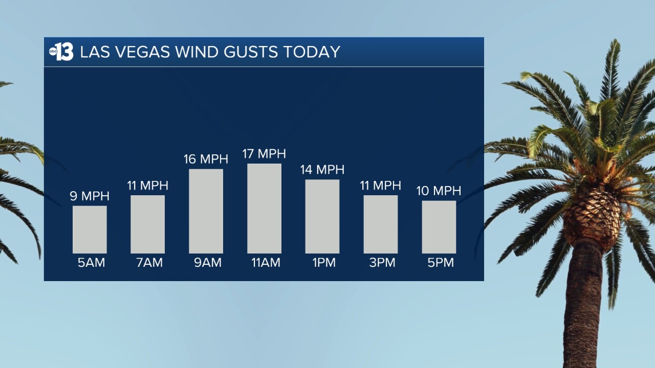
AFTERNOON: Sunny with highs in the low 80s and northeast breezes of 5-15 mph.
EVENING: Clear with lingering breezes of 5-15 mph and temperatures in the 70s.
TONIGHT: Lows in the low 60s with 5-10 mph breezes and a clear sky.
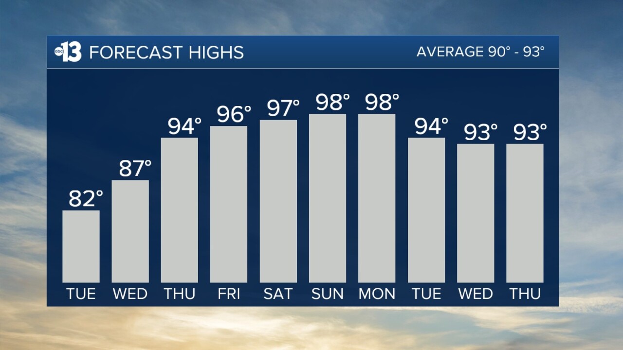
Wednesday is sunny and calm and in the mid 80s; Thursday is mostly sunny and hotter, with mid 90s for the first time since last week.
Friday marks a return of south breezes at 10-20 mph and partly cloudy conditions; highs remain in the mid 90s.
Some 20-25 mph gusts are expected Saturday and Sunday, respectively. Highs range from the mid-to-upper 90s this weekend with sunny conditions.
Nighttime lows in the low-to-mid 60s through midweek will rise to the upper 60s by the weekend.
Highs will be in the upper 90s Monday, and then mid 90s through the rest of the week. By the following weekend, it's in the mid-to-upper 90s, and we'll stay that hot as we flip the calendar to June early the following week.
Forecast pollen levels are "medium" today and tomorrow, then "low" Thursday and Friday. Ragweed, olive, and grasses are listed as the predominant pollen types. Showering and changing after you've been outdoors, keeping windows closed when it's windy, and vacuuming and dusting often will help battle symptoms, in addition to taking allergy medication.
The air quality forecast is "moderate" today and tomorrow for ozone.
Sun protection is advised between 9 a.m. and 5 p.m. today; a hat, light-colored clothing, and sunscreen are important when you're outside. The UV index is strongest from 10 a.m. through 3 p.m., when a sunburn can happen in 15 to 30 minutes.