

LAS VEGAS (KTNV) — The wettest day of our forecast period has arrived, with rain expected off and on through most of Saturday.
Rain this morning was, again, mostly insignificant, with rain gauges in the west and northwest parts of the valley showing around .04 inches as of 10:30 a.m., though that's when showers really started to pick up.
We expect a bulk of our heaviest and most intense periods of rain this afternoon, starting around 2 p.m. and taking off through the evening.
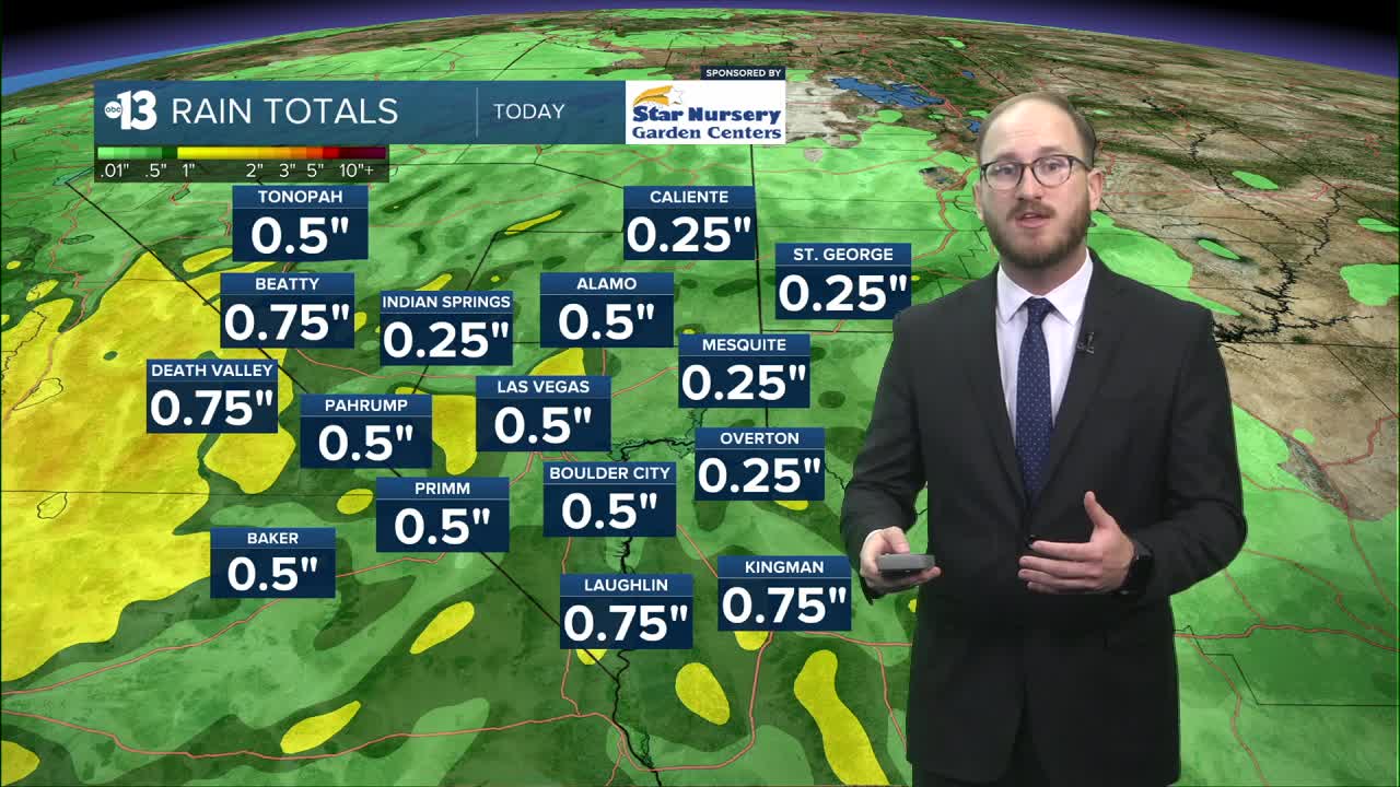
Precipitation totals have been difficult to predict for this round of showers, but recent models are showing give or take half an inch of rain is possible today at Reid Airport, with some of our neighborhoods possibly seeing upwards of an inch — that would be a significant amount of rain, considering our monthly average rainfall for November is .3 inches, and the record rainfall for November 15 was .52 inches set in 1964.
There are currently no watches or warnings in place for our viewing area, however there is a Flood Watch in place for the high desert in eastern California through this evening for San Bernardino and Inyo Counties.
Flooding isn't too big of a concern here in the valley today, although if we get periods of intense rainfall localized flooding is likely — it just depends on how the storms shake out. Regardless, be extra careful on super slick roads today, and if you see flooding, turn around, don't drown!
Our high temps today will be in the low to mid 60s, however we expect them to cool off a bit into the upper 50s once showers start to pick up this afternoon. Overnight lows will be in the low 50s for most of us.
Looking ahead, we're still seeing light rain chances tomorrow, specifically tomorrow late morning and early afternoon. Rain totals are forecasted to be extremely light though, very similar to what we saw yesterday.
Rain chances will stick around Monday and Tuesday in the 20-30% range, with a break from the action on Wednesday, before more slight chances return to round out the week.
All of this unsettled weather is thanks to continued areas of low pressure moving off the Pacific Ocean and through California, which will also keep temperatures below normal next week, with highs in the upper 50s likely on Tuesday and Wednesday.
Have a great weekend!
