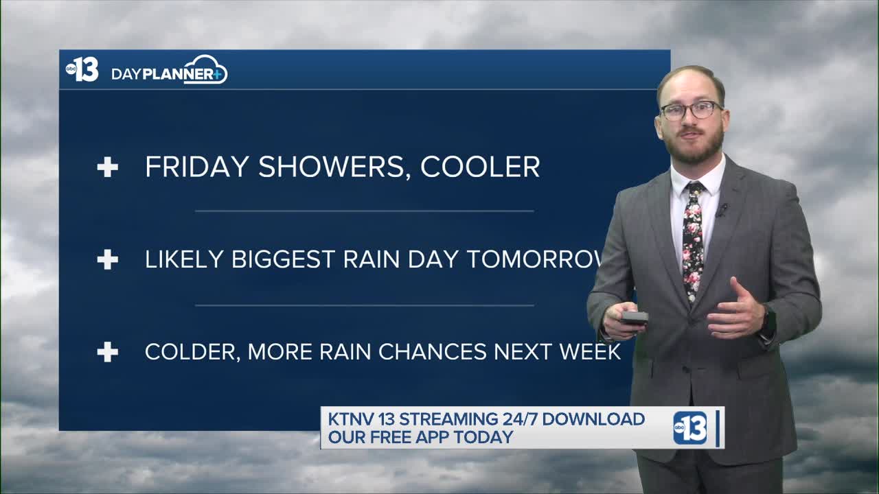


TODAY: Light rain off and on throughout the day but a break is possible around lunchtime, high temps around 70
TONIGHT: Rain chances through the evening, overnight lows dip into the upper 50s
TOMORROW: Biggest rain day of the forecast period with periods of heavy rain likely, daytime highs in the mid 60s with overnight lows in the mid 50s
LOOKING AHEAD: Staying cool in the upper 50s and low 60s, rain chances stick around through the weekend and well into next week
_____________________________________________________
Happy Friday! We woke up to some slick roads this morning thanks to periods of light rain overnight across most of the Las Vegas Valley, however total rain accumulation was very limited — only about .01" was officially recorded at Reid Airport, with rain gauges in the west, northwest and northeast parts of the valley showing .04" of rain this morning.
Periods of light rain are expected off and on throughout the rest of the afternoon and evening on Friday, with some breaks in the action possible around lunch time. Rain accumulation is expected to stay relatively low, though, however that can still create slick roads on the drive home.
We're calling for 71 degrees at the airport for Friday, with most neighborhoods cracking the 70 mark and hovering in the low 70s. We reached 79 yesterday at the airport, so we're expecting an eight to 10 degree drop today. Overnight lows remain in the upper 50s tonight.
Friday's just the appetizer for our main course on Saturday, where we're expecting moderate to heavy rain most of the day — in fact, rain chances are north of 90% right now... how often can we say that in the desert?!
Rain totals are still a little bit uncertain at this point, but some models show us potentially getting between .5-.8 inches of rain tomorrow, which would be significant to say the least — our normal average precipitation for the entire month of November is .3 inches!
We're expecting another significant temperature drop tomorrow, too, with daytime highs down below normal into the low to mid 60s. That means we'll be seeing a swing of about 15 degrees from 79 on Thursday to 64 on Saturday.
Looking ahead, rain chances and cooler temperatures are sticking around through the rest of the weekend and into next week. Sunday's rain chances are between 40 and 60%, though some models aren't quite sure exactly how Sunday's storms will shake out at this point.
From there, rain chances will decrease gradually to start the work week, but will be between 10 and 20% for most of next week. High temperatures are forecasted to dip down into the upper 50s by Tuesday and Wednesday!
Have a great Friday, and enjoy the wet weekend ahead — just be sure to take it extra careful on our roads!
