

TODAY: Official daytime high at Reid Airport of 93°, mostly sunny skies and breezy conditions
TONIGHT: Overnight lows in the low to mid 70s with clear skies and light winds
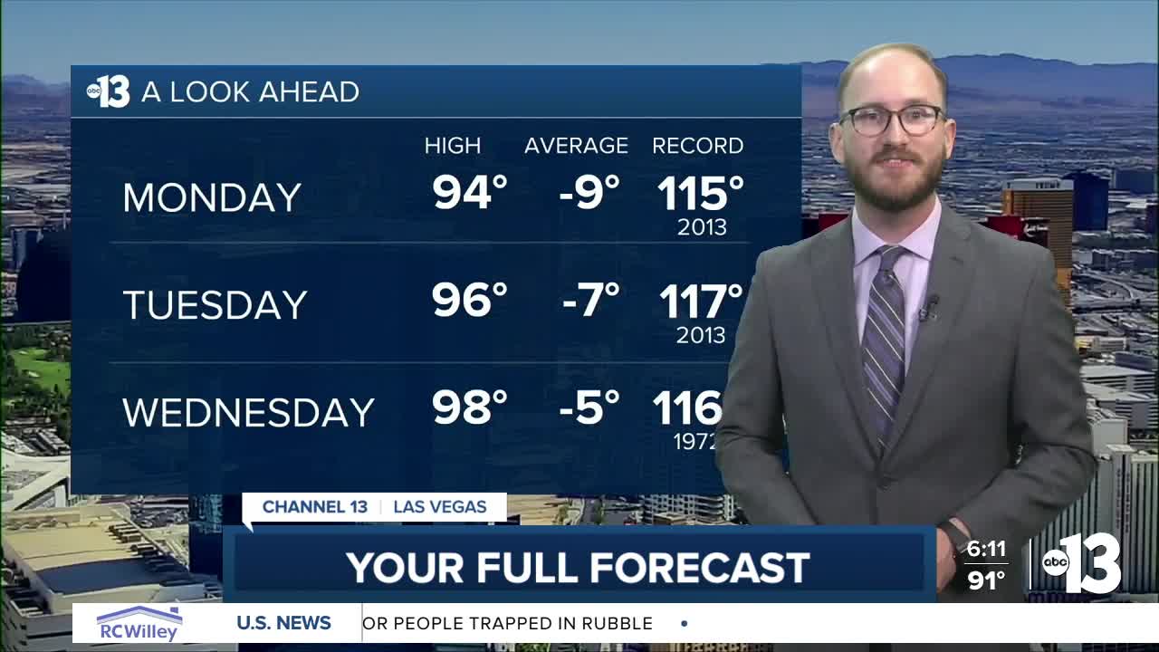
THIS WEEK: Temperatures remain below normal in the 90s for the first half of the week, as a gradual warm up back near and above normal to temps in the triple digits is in store for Independence Day weekend
______________________________________________
What a beautiful Sunday we had today across Southern Nevada, right?
Sunday is anticipated to be the coolest day of the forecast period, only reaching 93° for our official high temperature at Harry Reid International Airport — that's 10° below our normal high of 103°. Overnight low temperatures will be in the low to mid 70s.
Winds were breezy but not super impactful and will likely stay that way for the first half of this week, which is a marked shift from the last several days, when we saw gusts between 45-50 mph across much of our area.
WATCH| Answering Your Questions: Has it been windier than normal this spring?
As we take a look ahead to the start of the work week, we'll still see temps around 10° cooler than normal for this time of year on Monday — again, "cooler" is a relative term, but I don't think anyone is complaining about temperatures in the 90s to wrap up June.
We'll stay in the mid-90s on Tuesday, but temperatures will be slowly climbing back near triple digits by the end of the week, before warming back near and above normal, comfortably in the triple digits by Independence Day weekend across Southern Nevada.
WATCH| How El Niño weather pattern might affect Las Vegas
Light breezes are likely to stick around at times this week, possibly peaking on Thursday, but won't play a major factor in our forecast.
Have a great work week!
