

THIS MORNING AND AFTERNOON: Widespread showers likely to arrive after 10 a.m. and persist through most of the day, 50-60% chance of rain — daytime high temperatures in the upper 80s and low 90s
TONIGHT: Showers likely to stick around through most of the evening, but will calm down closer to midnight — overnight lows in the mid 70s
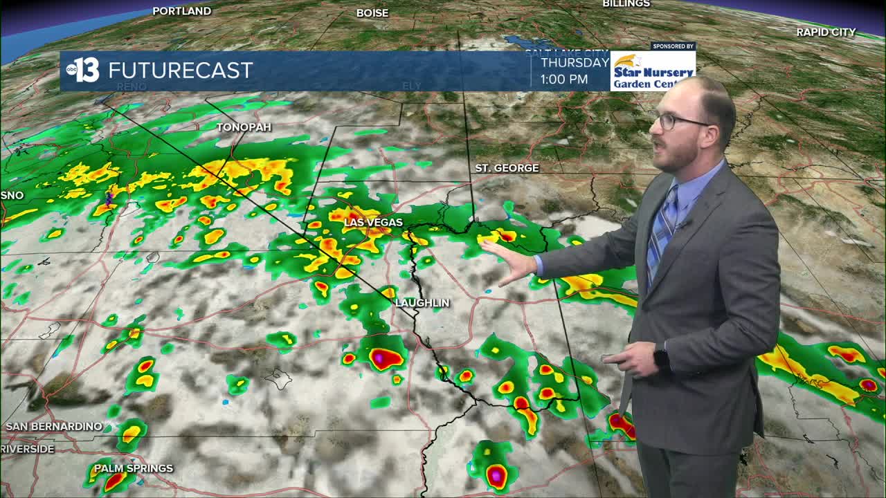
TOMORROW: Thunderstorms possible, especially in the afternoon, 50% chance of precipitation — daytime highs in the upper 80s
THIS WEEKEND: Slight chance of storms Saturday but much calmer by Sunday — highs in the low to mid 90s
______________________________________________________
We're waking up to a fair amount of cloud cover here in the Las Vegas valley, as moisture from the remnants of Tropical Storm Mario continue to make their way to Southern Nevada.
Around 8:30 a.m., radar showed a wide band of showers moving north from the greater Southern California across San Bernardino County (where a Flash Flood Watch is in place all day Thursday), stretching from Cal-Nev-Ari all the way towards Bakersfield.
As of 9:30 a.m., that initial band has worked into extreme southern Clark County, with showers arriving in Laughlin, Searchlight and the California-Nevada state line.
Latest model runs show this band of showers is set to arrive in the valley after 10 a.m., with widespread showers expected through the rest of the late morning and into the afternoon. Rainfall is also likely to increase in intensity as the morning turns into afternoon, when we'll see the greatest chances for thunderstorms to develop.
Storms are expected to stick around into the evening, lasting through the 10 p.m. hour.

Whether or not this rain will turn into thunderstorms depends on if we'll get breaks in the cloud cover, which would allow sunshine through and generate daytime heating that fuels thunderstorm formation. With how much cloud cover we've seen today, this is the factor we're keeping our eye on the closest this morning.
Still, these storms could generate damaging high winds and flash floods, so keeping an eye on the sky and staying weather aware today is a must.
If you have any pictures or videos from today's rainfall, we'd love to see them and use them in our forecasts and online! You can submit them to us by heading to ktnv.com/weatherpics.
All of this cloud cover and increased tropical moisture will keep temperatures much cooler than the 99 degrees we observed at Harry Reid Airport yesterday. We're forecasting daytime highs in the upper 80s and low 90s for neighborhoods in the valley, with an official reading of 89 or 90 at Reid Airport. Temperatures overnight tonight will be in the mid 70s.
Storms will calm down overnight for a brief period, but moisture remains in our atmosphere tomorrow, keeping our chances for afternoon showers thunderstorms at 50%. Daytime highs tomorrow will be a notch or two cooler, in the upper 80s, with overnight lows once again in the mid 70s.
Chances for storms will slowly die down as Friday rolls along, with an outside chance for a shower or two Saturday. The weekend is looking substantially calmer, though, with daytime highs in the low to mid 90s both Saturday and Sunday.

