

TONIGHT: Cloudy. SW Wind 10pmh. Low: 69°
TOMORROW: Windy with SW winds up to 30mph, gusts up to 50mph. 20% chance of spotty showers in the evning. High: 81°
WEDNESDAY: Sunny. Breezy with SW winds up to 15mph, gusts up to 25mph. High: 79°
Today it reached 88 degrees in Las Vegas, the first day under 90 degrees since March 17th. We did not break a high temperature record. That means in total, we had 12 days in a row with record-breaking heat. We are still on track for the #1 warmest March on record.
But good news! It's going to start feeling a lot more like spring this week.
Multiple low-pressure systems will descend into the region this week bringing cooler temperatures, wind...and even some rain chances.
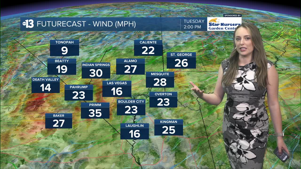
Strong, gusty winds are in play Tuesday with a Wind Advisory issued starting at 11AM tomorrow for Clark County and Southern Nye County. This expires on Wednesday at 2AM. We'll see wind speeds 20-30mph with some gusts upwards of 50 miles an hour. There will be a potential for power outages, strong crosswinds, and blowing dust and debris. Clark County has issued a Dust Advisory.
There is also a 20% chance of rain Tuesday evening, so we could see a few spotty showers.
Starting tomorrow, highs will drop to the low 80s/upper 70s in the valley. That will represent about a 10 degree drop temps, so it should feel significantly cooler. Our coolest day of the forecast period is Friday with a high of just 74 degrees. The average high temperatures for this week are 75 - 76 degrees.