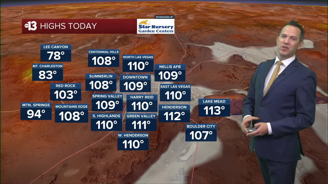


LAS VEGAS (KTNV) — Las Vegas temperatures move from the mid-and-upper 80s at sunrise to the 90s by 8:00 a.m. and the 100s by 10:00 a.m. Make sure kids have plenty of water, a hat, and sunglasses for the walk to and from school. Southwest winds up to 15-25 mph are expected this afternoon. The Extreme Heat Warning has been extended until 8:00 p.m., and highs will hit 110° between 4:00 p.m. and 5:00 p.m. This evening won't drop back to the 90s until after 9:00 p.m., and late night lows will remain warm, in the mid-and-upper 80s.

Highs hit 107° Thursday as afternoon southwest breezes reach 15-25 mph. Rain chances are meager tomorrow, at 10%, but the humidity will go up through the end of the week into the weekend.
Friday sees a 20% chance of rain and storms around Las Vegas, and a mostly cloudy sky keeps highs near 102° with south winds at 15-25 mph.
Saturday is partly cloudy and warm, with highs near 100° as south winds return to 15-25 mph and a 10% rain and storm chance lingers.
Sunday is still breezy in the afternoon as temperatures reach 102° with mostly sunny conditions and some noticeable humidity.
Winds die down on Monday and Tuesday as highs remain at 103°-104°, which is close to average for mid-August.
The UV index is "very high" from 11 a.m. to 2 p.m. (sunburn in 15 minutes). Sunscreen, a broad hat, and light-colored, lightweight clothing are smart if you're outside for any length of time between 9:00 a.m. and 4:00 p.m.
The forecast pollen levels are "medium" this week, with ragweed, grass, and sagebrush the predominant pollen types.
