

TONIGHT: Mostly clear Low:67° Winds: SW 5-10
TUESDAY: Sunny High:97° Winds: SE 5-10
WEDNESDAY: Sunny High:97° Winds: NW 5-10
Monday’s Haiku
Sixties overnight
Sunny and hot on Tuesday
Highs in the nineties
Harry Reid Airport reached 96° setting a new daily record.
Clear and mild tonight with lows in the upper 60s. A strong area of high pressure will keep record breaking heat in place in Southern Nevada.
Highs will reach into the 90s during this historic heat wave. These temperatures are more typical of May and June than late March. Daily records are expected to break through most of the week. A slight cool down is on the way by Sunday and temperatures will continue to drop early next week.
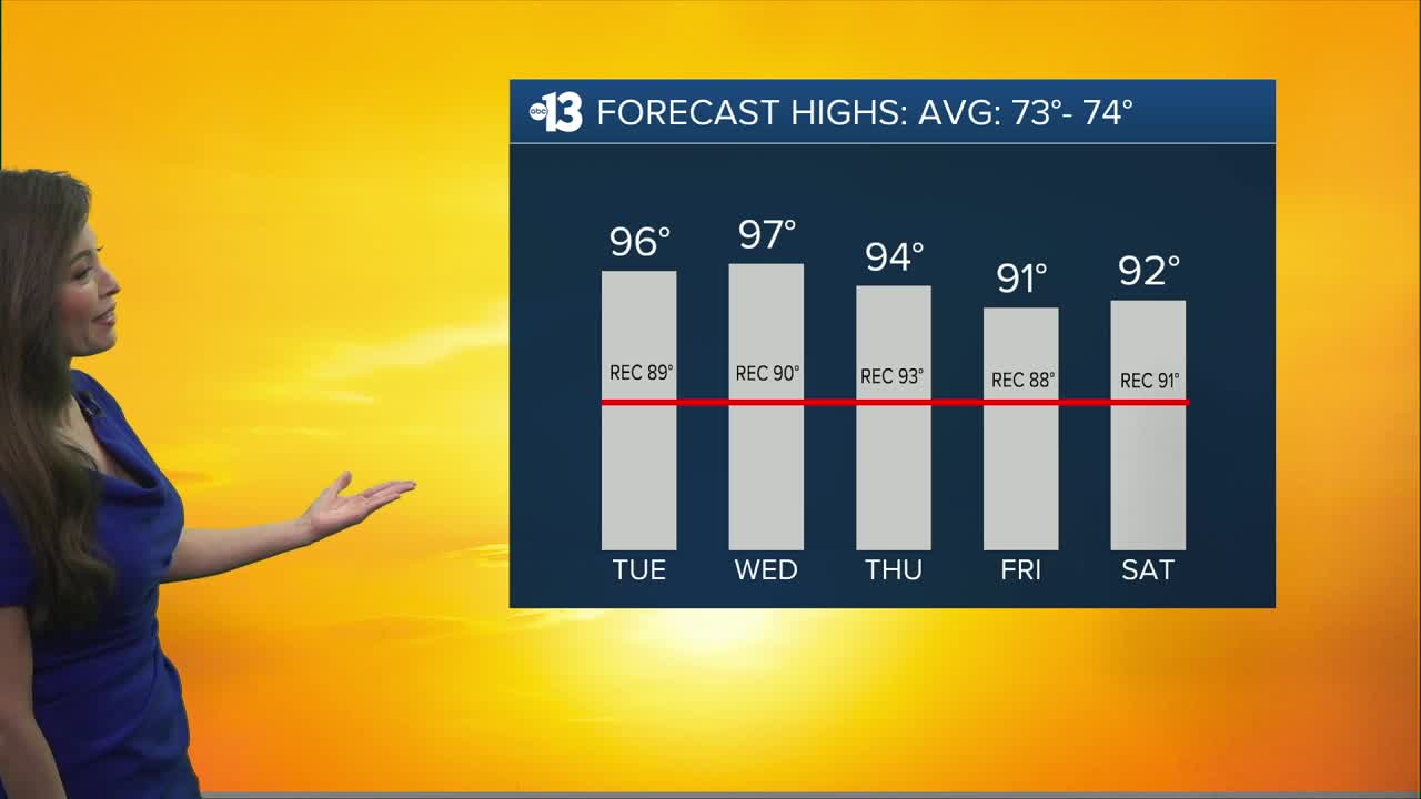
Tuesday 96° (Record 89°) Wednesday 97° (Record 90°) Thursday 94° (Record 93°) Friday 91° (Record 88°) Saturday 92° (Record 91°) Sunday 89° (Record 89°) Monday 84° (Record 90°)
Limit time outdoors between 10am-5pm, stay in air conditioning when possible and drink plenty of water and sports drinks. Wear a hat and sunscreen if you’re going to be outside. Do not leave young children and pets in unattended vehicles and remember to check on neighbors and the elderly.