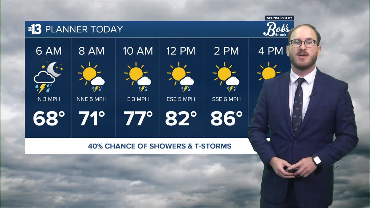


THIS AFTERNOON: Shower and thunderstorm chances around 25-40% through the evening, daytime high temperatures in the upper 80s
TONIGHT: Rain chances decrease overnight as moisture decreases, temps in the low to mid 70s
TOMORROW: Slight storm chances early, but mostly dry with highs in the low 90s
LOOKING AHEAD: Conditions continue to dry out as temperatures warm back up closer to normal for this time of year, in the mid 90s
___________________________________________________
It was a wet Thursday in Las Vegas, with widespread showers picking up in the afternoon and carrying through the evening.
In fact, 0.24 inches of rain were observed at Harry Reid Airport, which is the first time the airport's gotten measurable rain since July 3.
WATCH | Wrapping up Thursday's rain totals around the valley
As we look towards the rest of the day today, storm chances stick around thanks to the moisture left behind from the remnants of Tropical Storm Mario moving through our region. If storms do develop, however, they're more likely to follow a monsoon-like pattern as pop-up thunderstorms, generated by increased daytime heating due to less cloud cover today.
The best chance for storms looks to be this afternoon, especially in the noon to around 3 p.m. window, but storms could form any time this evening. Make sure you're weather aware as you leave the house today, and drive extra carefully on the roads today, as they're still slick from yesterday's rain and this morning's moisture.
Drier weather is ahead starting this weekend, save an extremely outside storm chance tomorrow morning, with more sun and warmer temperatures in the low 90s.
Looking towards next week, we're still staying dry and continuing a slight warming trend barely above normal for this time of year for the first half of the week, however early models are showing another chance for storms by the middle of next week thanks to another area of low pressure of the coast of California that could give us a pattern shift mid-week.
In the meantime, enjoy what's shaping up to be a wonderful weekend!
