

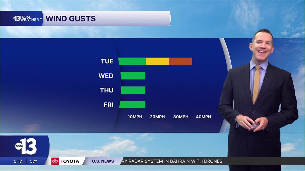


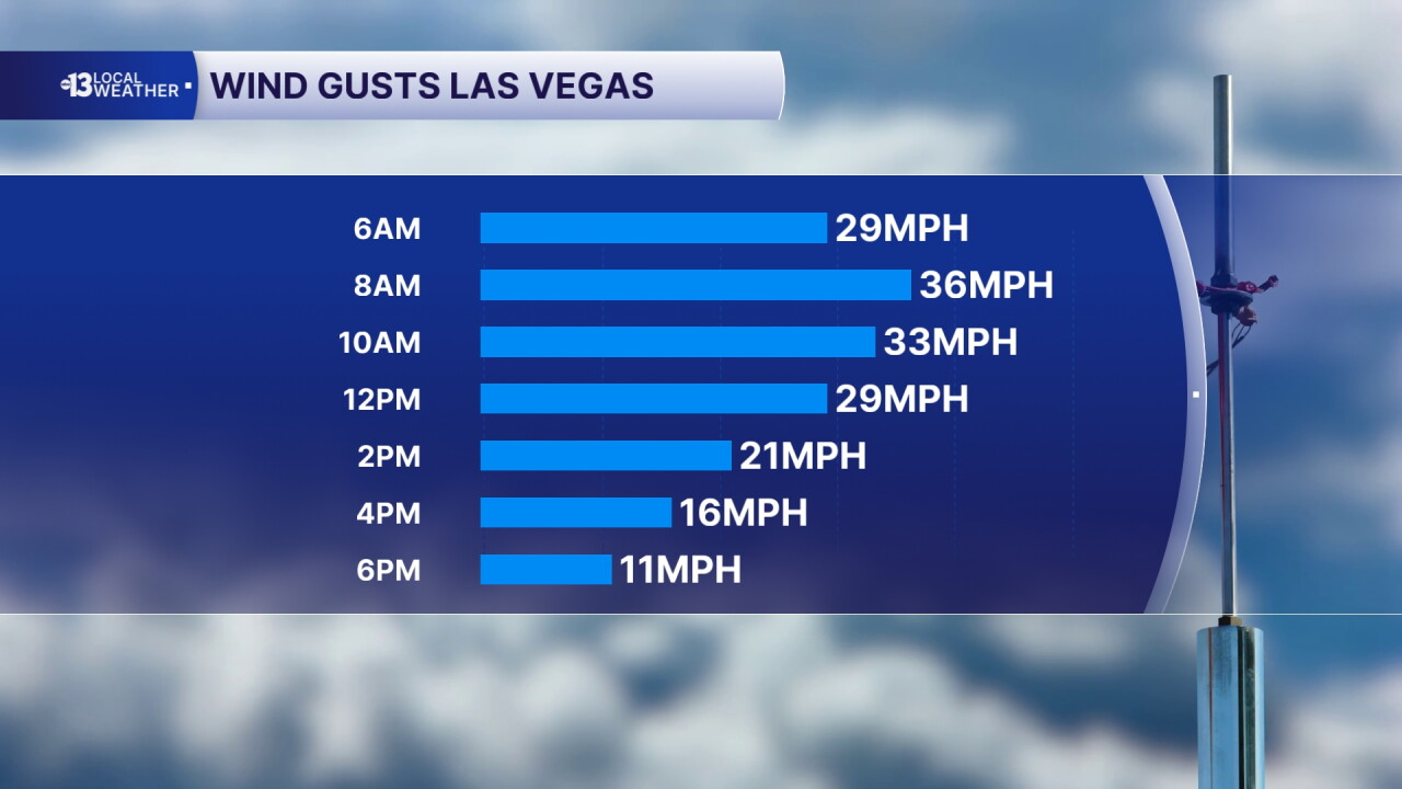
LAS VEGAS (KTNV) — MORNING: A few additional showers at daybreak, but a drying trend with increasing sun. Winds from the southwest will gust from 25 to 35 mph. Readings in the mid-to-upper 50s.
AFTERNOON: Mostly sunny with gusts of 30 mph in the early afternoon lingering at 20 mph in the late afternoon. Highs in the low 60s.
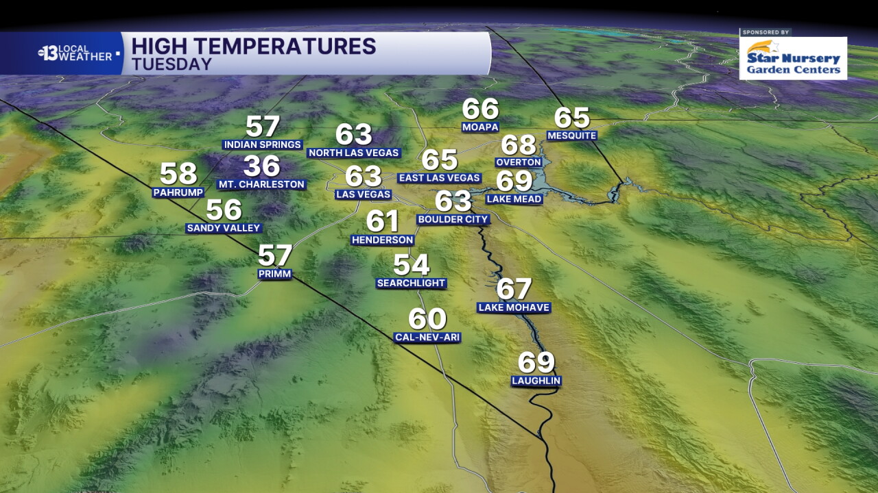
EVENING: Temperatures drop through the 50s with 5-15 mph breezes and a partly cloudy sky.
TONIGHT: Readings drop to the low 40s for the first time since April.
Wednesday starts in the low 40s, and afternoon highs are limited to the low 60s. Expect light winds and a partly cloudy sky.
Our next chance for showers arrives late Wednesday night and lasts through Thursday evening. Las Vegas expects a 60% chance for some measurable rain, around 0.10" in most spots. Several inches of snow are expected in the Spring Mountains. After starting in the 40s, valley highs won't escape the upper 50s on Thursday.
Similar chill in the mid 40s early Friday with light winds and highs limited to 60° despite being mostly sunny. Saturday starts in the low 40s, with upper 30s in some of the coldest valley neighborhoods, and highs are limited to the mid 50s with a mostly sunny sky and light winds.
Expect evening temperatures in the upper 40s Friday and Saturday with calm, dry conditions. Tire traction may be a consideration during the F1 qualifying session Friday (8-9 p.m.) and the Las Vegas Grand Prix Saturday (8-10 p.m.) on account of the chill.
Lows will be in the low 40s Friday night and Saturday night, so upper 30s are possible in some of our colder neighborhoods! Sunday and Monday look partly cloudy with cool highs in the upper 50s to near 60° and minor 10% shower chances.
