

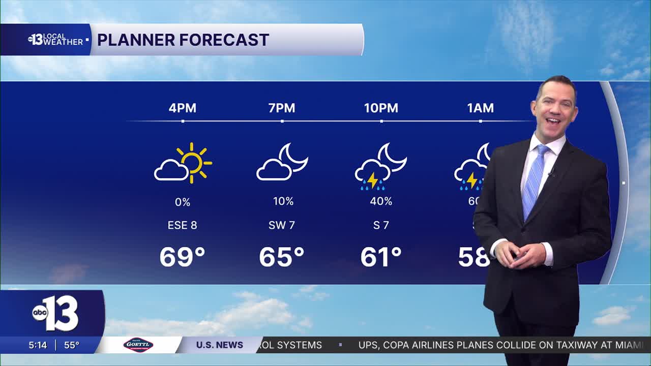


LAS VEGAS (KTNV) — MORNING: Cool (mid 50s) at sunrise with a partly-to-mostly cloudy sky and 5-10 mph breezes.
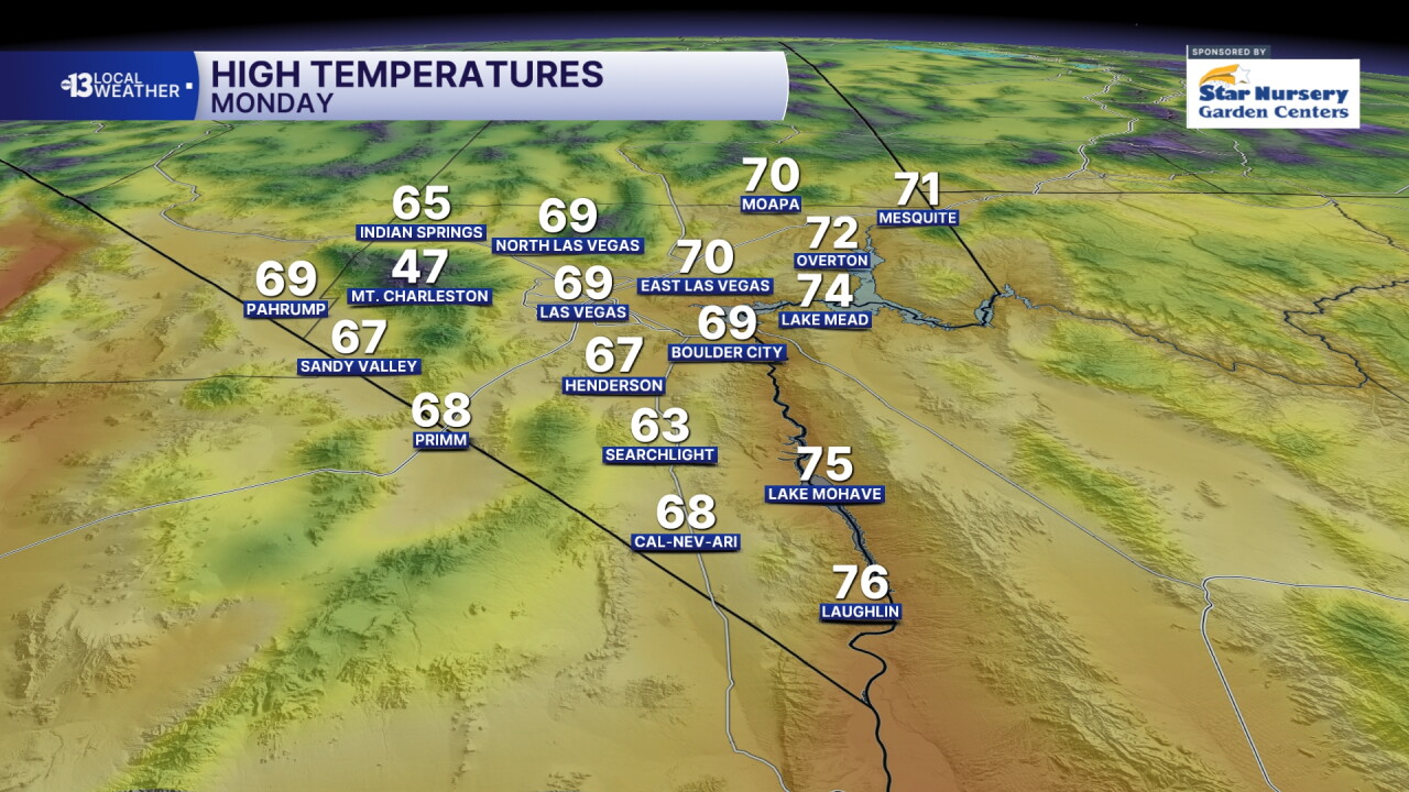
AFTERNOON: A 10% chance of a shower, otherwise mostly cloudy with 5-15 mph breezes and highs in the upper 60s.
EVENING: The chance of showers and thundershowers will climb to 40% after dark as readings fall to near 60° with south breezes at 5-15 mph.
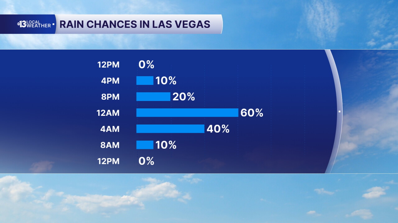
TONIGHT: Lows in the low-to-mid 50s with a 60% chance of showers and thundershowers and winds picking up to 15-25 mph.
Southwest winds pick up to 20-40 mph Tuesday morning, accentuating how cold wake-up temperatures in the 50s feel. Highs are limited to the low 60s Tuesday afternoon, when southwest winds continue at 15-30 mph.
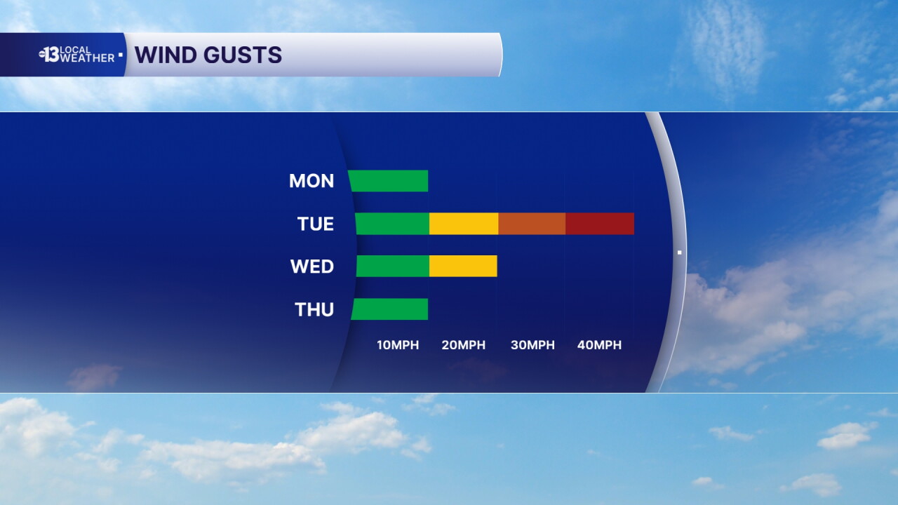
Tuesday night falls to the 40s in Las Vegas for the first time since April. Wednesday remains cool, in the low 60s, with partly cloudy conditions and fairly light winds.
Wednesday night through Thursday brings our next chance for showers, and readings Thursday will start in the 40s and won't escape the upper 50s in the afternoon.
Similar chill in the mid 40s early and the upper 50s later remains in place Friday. Ditto on Saturday. We'll have sun and partial clouds both days, with light breezes. Evening temperatures will be chilly, which may impact traction during the F1 qualifying session Friday (8-9 p.m.) and the race itself Saturday (8-10 p.m.).
Lows will be in the low 40s Friday night and Saturday night, so upper 30s are possible in some of our colder neighborhoods! Sunday looks mostly cloudy with continued cool highs in the upper 50s.
Sun protection is still advised between 10 a.m. and 2 p.m.; a hat, light-colored clothing, and sunscreen are important when you're outside. The UV index is high enough that a sunburn can happen in 30-45 minutes.
