
TONIGHT: Windy conditions persist through the overnight hours, low temps in the upper 70s and low 80s
TOMORROW: Wind Advisory and Red Flag Warning still in effect, gusts near 50 mph possible, daytime highs into the 90s
SUNDAY: Winds begin to calm down as Wind Advisory expires at 5 a.m., coolest day of the forecast period with temps in the low 90s
NEXT WEEK: Temperatures gradually start to warm back up but stay in the 90s until mid-week, will be back above normal by the Fourth of July
____________________________________________________________________________
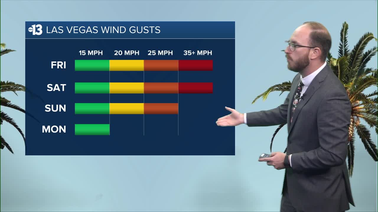
Winds are continuing to make their presence known across Southern Nevada, and they're going to stick around through early Sunday morning.
A Wind Advisory is currently in place until 5 a.m. on Sunday, due to sustained winds of 20-30 mph with gusts near 50 mph possible over the next couple of days — combined with significantly low humidity, that creates critical fire weather conditions, and there's a Red Flag Warning in place until Saturday at 11 p.m. to prove it.
We don't have to look too far to see how serious of a situation this is: friends and family in southwestern Utah are dealing with several major wildfires, including a couple new starts as of Friday evening, that are being fueled by these critical fire weather conditions.
While we're staying gusty over the next few days, expect to see periods of blowing dust and debris, potentially some downed tree limbs or a power outage or two. If you do have damage in your neighborhood, feel free to send us photos or video at KTNV.com/weatherpics.
NV Energy will also likely be de-energizing neighborhoods in Kyle Canyon and Angel Peak due to critical fire danger — they issued a Public Safety Outage Management warning tonight, which is set to kick in Saturday at noon and last through 10 a.m. Sunday.
The good news is that temperatures will be cooling down fairly substantially, especially for this time of year, as we head into the weekend and next week. Our high today was 103° at the airport, which is looking like our last day in the triple digits until the middle of next week.
We're looking at highs of 97° on Saturday, 92° on Sunday and 94° on Monday, which are all substantially lower than our average high of 103° for this time of year.
As the winds calm down even further into Monday, temperatures will begin their slow climb back up to the triple digits by mid-week, as we're looking at temperatures at or hot seasonal norms by Independence Day.
Have a great weekend!
