We're almost at the halfway point in December, but for the rest of the week and into the weekend, it's going to feel more like early October.
Temperatures across the country are already warmer than what we typically see in the first half of December.
Now, even warmer air is beginning to move into the middle of country, which will eventually move into the Midwest and to the East Coast throughout the week and into the weekend.
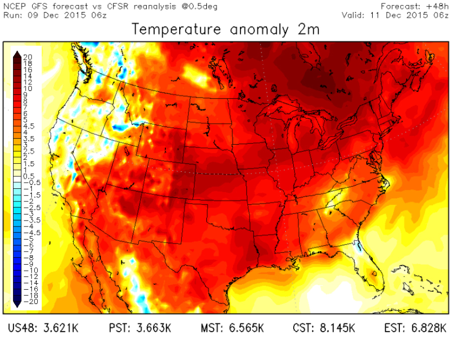
These temperatures will likely be upwards of 10 to 20 degrees higher than what we typically see in December.
In fact, it'll be so warm that overnight lows will likely be warmer than a typical December afternoon high temperature!
The unexpected warmth comes thanks to the jet stream flowing a little farther north than usual for this time of year.
The jet stream not only steers most of the weather across the United States, but it also holds cold arctic air to the north. Since the jet stream is staying to the north, so is all the cold air.
Download the SnowCast App for snowfall totals at your location
But fear not cold weather lovers, some of that winter chill should be returning by next week.
Just don't go holding your breath for a White Christmas.
Follow Digital Meteorologist Jason Meyers via the Storm Shield app on Twitter, Facebook, and YouTube. Download the Storm Shield Weather Radio App for your iPhone or Android device and get severe weather alerts wherever you are. Named by Time.com one of the best weather apps for your iPhone.
