

The Oroville Dam in northern California began overflowing this past weekend, which spurred the mandatory evacuation of 188,000 people nearby.
So how did the nation's tallest dam go from the status quo to overflowing in such a short time?
The short answer — lots and lots of rain in a very short amount of time.
At the beginning of the year, more than 80 percent of California was experiencing some sort of drought conditions. Now, that number is down to roughly 60 percent, and the worst of it has been erased off the map.

Record amounts of rain have fallen across California, and the northern Sierra Nevada mountain range has experienced one of its wettest seasons on record.
RELATED: Storm Shield app provides life-saving weather alerts
RELATED: SnowCast tells how much snow will fall at your location
All of that rain and snow feed into Lake Oroville.
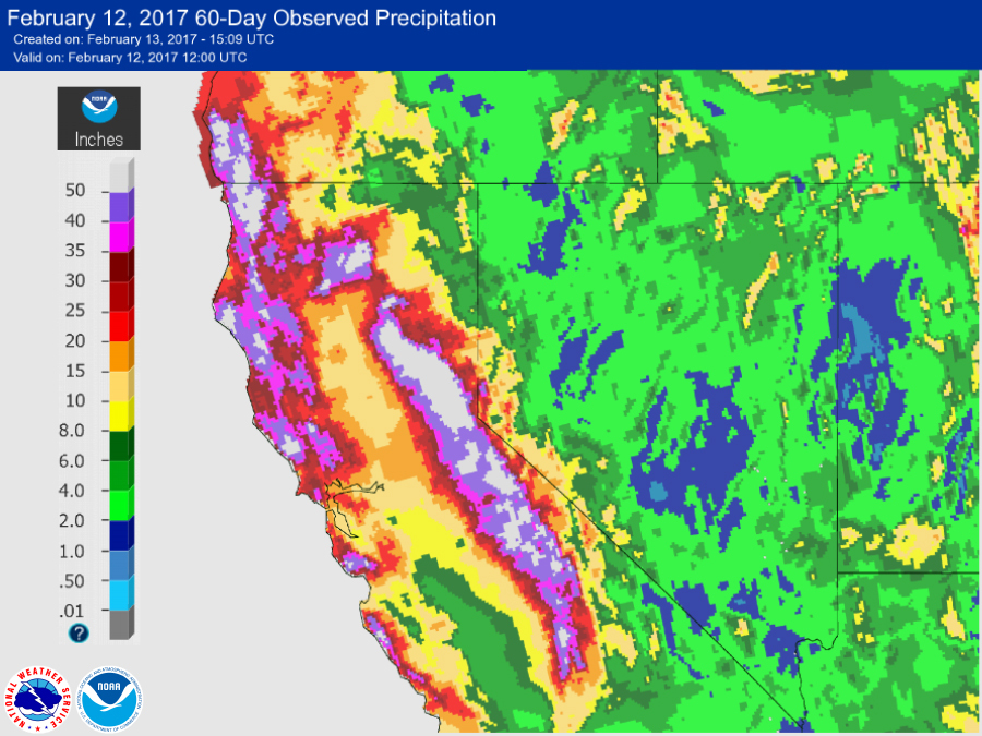
In the last 60 days, parts of California and Nevada have received 600 percent of their average rainfall.

If you're wondering how much rain that equates to in inches, some places received 50 or more inches of rain in almost just as many days.
California is experiencing a stretch of dry weather at the beginning of this week, but more rain is expected in the northern half of the state near the Oroville Dam on Thursday and Friday.
Follow Storm Shield Meteorologist Jason Meyers via the Storm Shield app on Twitter, Facebook, and YouTube. Download the Storm Shield Weather Radio App for your iPhone or Android device and get severe weather alerts wherever you are. Named by Time.com one of the best weather apps for your iPhone.
