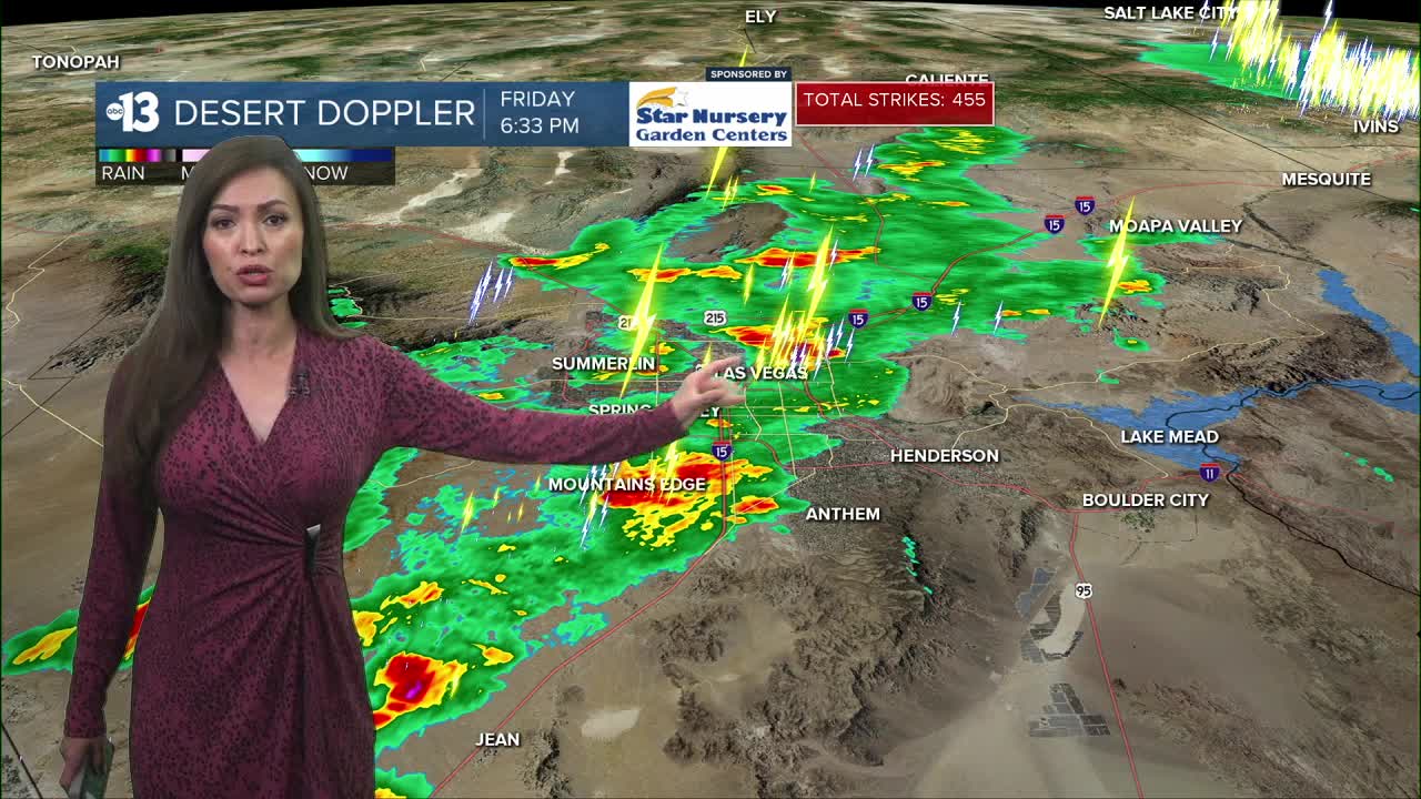


LAS VEGAS (KTNV) — Storm systems moved into the Las Vegas Valley on Friday, bringing heavy rainfall, flooding some roadways, and resulting in some power outages and flight delays.
Current Conditions
- Humidity: 15%
- Dew point: 48°
- Pressure: 29.7 in
- Wind speed: 14 mph
- Wind direction: SSW
- Visibility: 10.0 mi
- Sunrise: 05:33 AM
- Sunset: 07:59 PM

RAIN TOTALS
The National Weather Service recorded rainfall of 0.92 inches from Friday's storm system. Channel 13 meteorologists ran the numbers, and that makes October 10 the fourth-wettest October day on record.
Normal precipitation for the month of October is about one-third of an inch.
WEATHER ALERTS
From the National Weather Service:
Flood Advisoryfor northern Las Vegas Valley until 9:45 p.m.Flash Flood Warningfor Red Rock Canyon and Blue Diamond until 9 p.m.Flash Flood Warningfor southwest Clark County until 8:45 p.m.Flash Flood Warningfor central Clark County until 7:45 p.m.Flash Flood Warningfor Sandy Valley until 7:45 p.m.Flood Advisoryfor central Clark County until 7:45 p.m.- Flood Watch for Spring Mountains and Red Rock Canyon until 11 p.m. Saturday
- Flood Watch for Lincoln County until 11 p.m. Saturday
POWER OUTAGES
As of 10 p.m., NV Energy is reporting:
- Around 600 customers without power in Clark County
FLIGHT DELAYS
According to the Federal Aviation Administration, you can expect the following through at least 11:59 p.m. Friday:
- Ground Delays averaging 138 minutes
- Departure Delays averaging 75 minutes
MORE INFORMATION
From the Regional Transportation Commission of Southern Nevada:
- A water rescue is underway in the central valley.
- Flooding on the roads around Cambridge Street between Flamingo Road and Katie Avenue. Use caution; avoid the area if you can.
- Flooding on the roads around Lake Mead Parkway and Boulder Highway. Use caution; avoid the area if you can.
- Flooded roads in the area of Las Vegas Boulevard and Cheyenne Avenue. Use caution and avoid the area if you can.