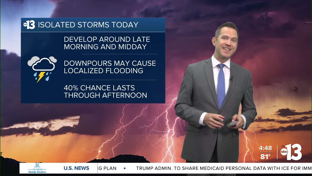


LAS VEGAS (KTNV) — After spotty thunderstorms on Thursday, Las Vegas expects isolated storms to redevelop over nearby mountains before lunchtime and drift into parts of the valley (40% chance) from midday through afternoon. Localized heavy rain, lightning, and gusty outflow winds are possible.
Temperatures start near 80° with a partly cloudy sky, and highs are limited to the upper 90s. Lows at night in Las Vegas this weekend will be in the low 80s.
Saturday yields a 10% rain and storm chance in the afternoon, otherwise it looks mostly sunny, a bit muggy, and warmer as highs are back to 103° (with light winds at 5-15 mph).
Sunday through most of next week sees low humidity and increased winds. Highs are between 102° and 104° during this stretch. Wind gusts reach 20 mph Sunday, 30 mph Monday, and 25 mph on Tuesday and Wednesday.
Smoke, mainly aloft, continues to swirl around Southern Nevada as wildfires burn in Nye County, northern Arizona, and central Utah.
The UV index is "extreme" from noon to 1 p.m. (sunburn in 10 minutes) and "very high" from 11 a.m. to 2 p.m. (sunburn in 15 minutes). Sunscreen, a broad hat, and light-colored, lightweight clothing are smart if you're outside for any length of time between 9:00 a.m. and 5:00 p.m.
The forecast pollen levels are "low-medium" today, and "medium" tomorrow through the end of the work week. Ragweed, grass, and chenopods are listed as the predominant pollen types.
